
DJI Matrice 5T
Always in Its Element
A compact enterprise flagship built for the toughest jobs. The Matrice 5T combines LiDAR, mmWave radar and omnidirectional vision with an IP55 rating, so it keeps flying through rain, dust and darkness. 1K thermal, full-colour night vision and up to 59 minutes of flight time put more detail and more coverage into every sortie.
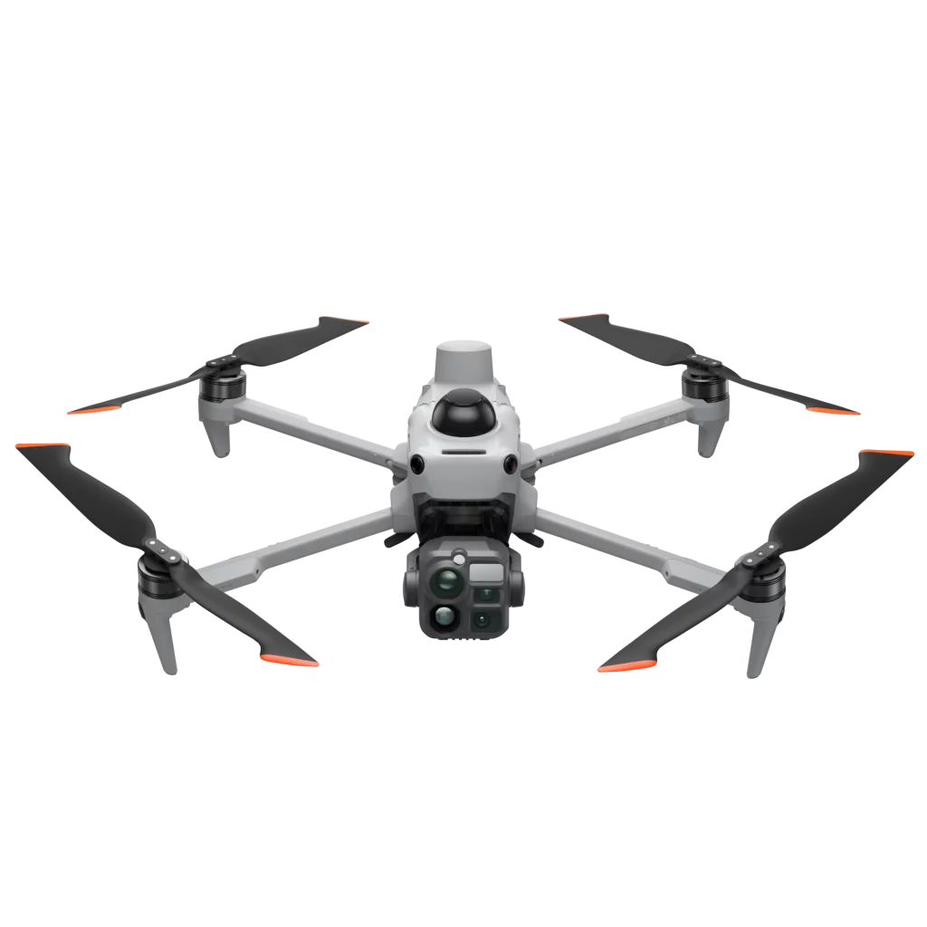
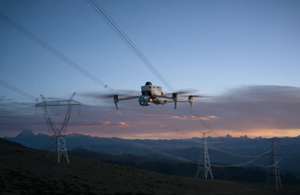
- Built for emergency response, power line and infrastructure inspection, surveying and public safety, the Matrice 5T is a complete intelligent platform.
- Onboard AI detects over 20 target types, O4 Enterprise transmission and multiple relay modes extend your reach, and DJI Pilot 2, DJI FlightHub 2 and DJI Terra turn every flight into actionable data.
Key Features
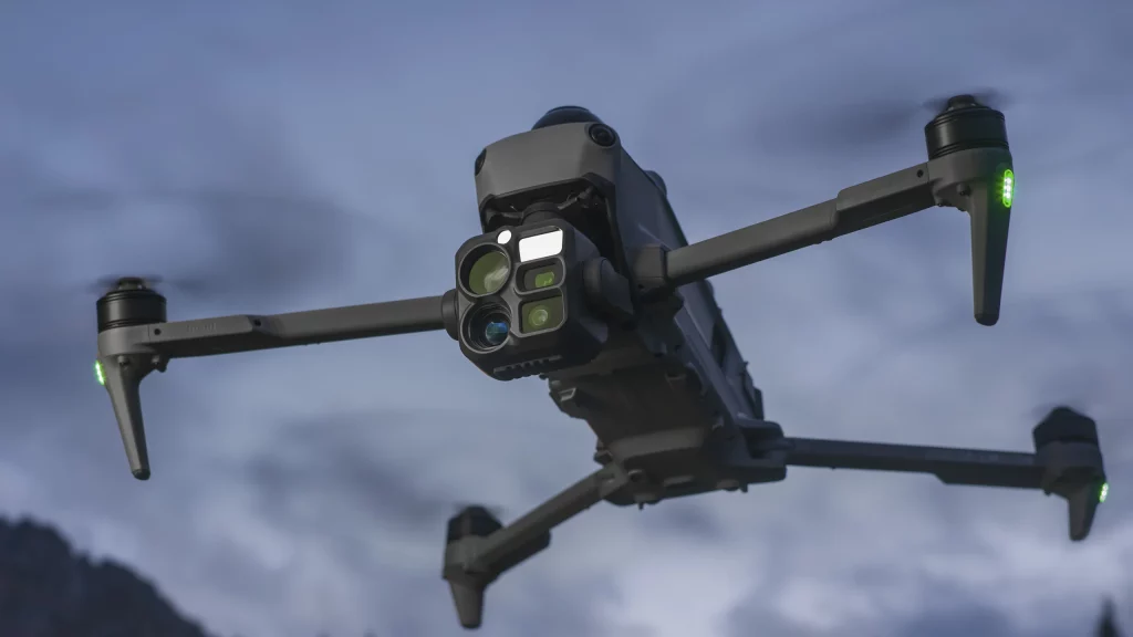
1K Thermal Imaging, Enhanced Night Vision
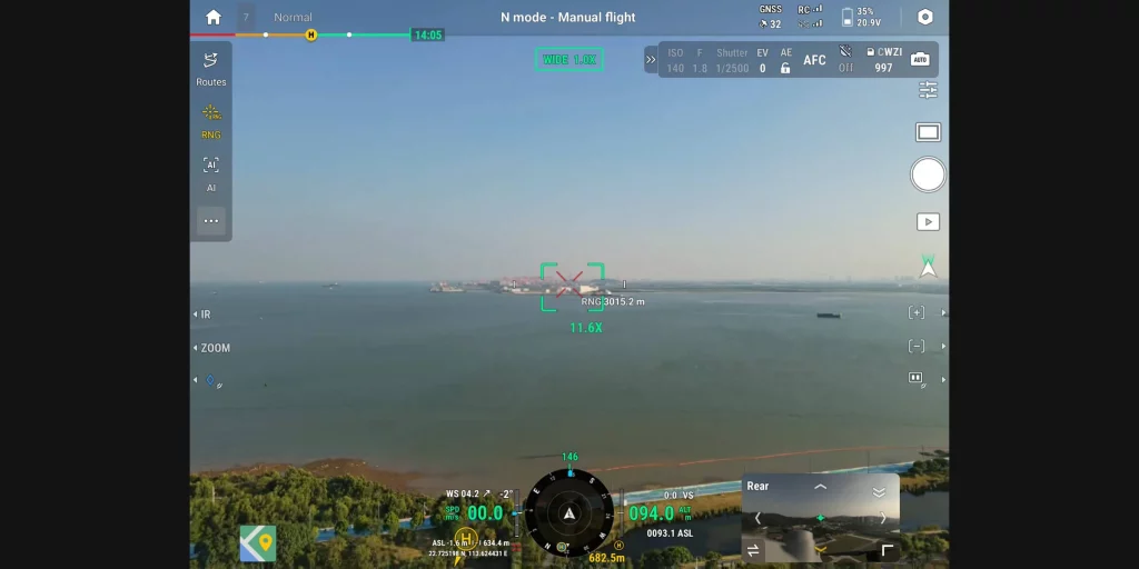
Ranging and View Assist
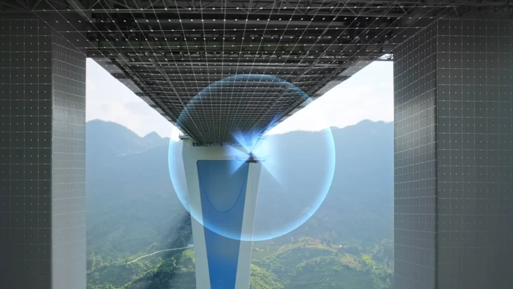
Omnidirectional Sensing, IP55 Rating
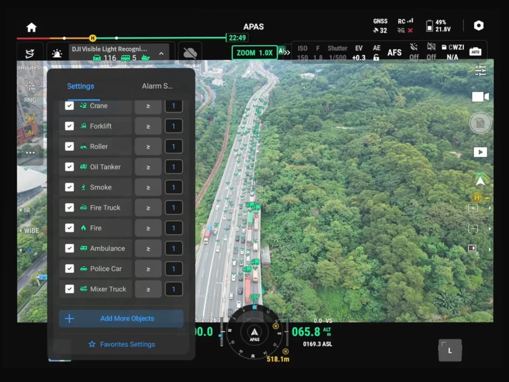
Open Edge AI, On-Site Intelligence

O4 Enterprise Transmission, Multiple Relay Modes
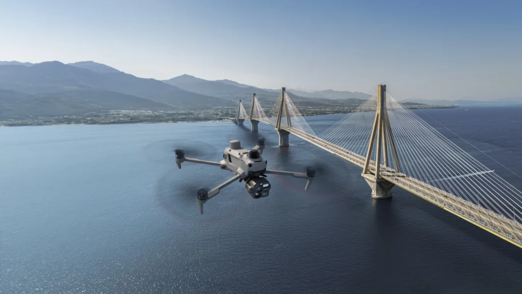
Robust Power, Extended Endurance
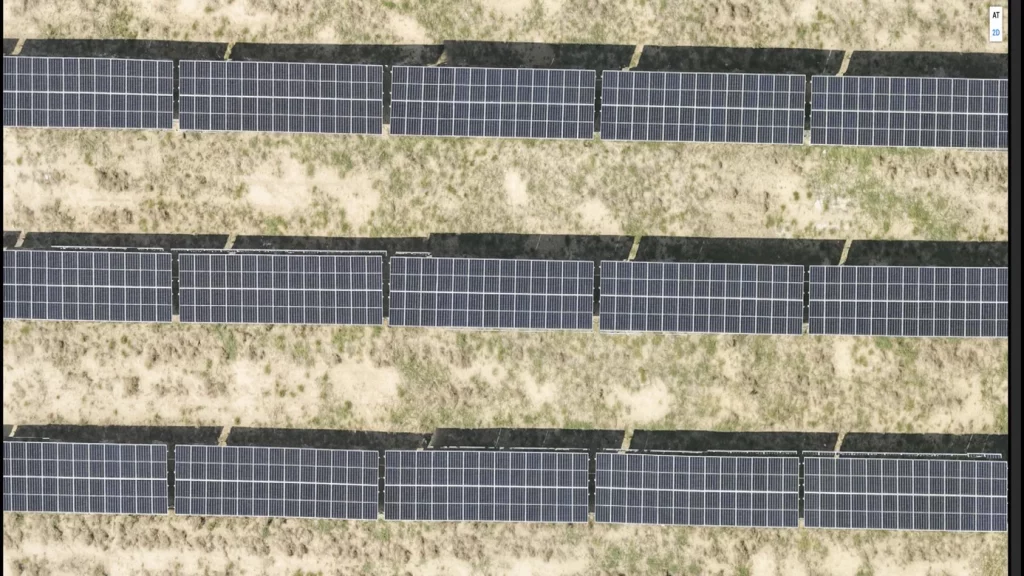
High-Accuracy Surveying, Rapid Modeling
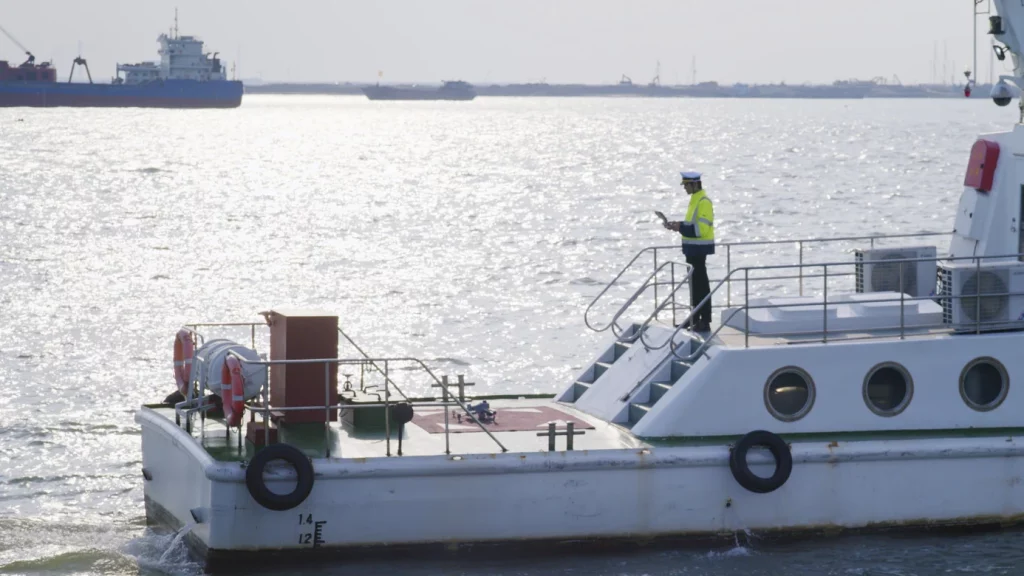
Versatile Applications, Custom Pilot Plugins
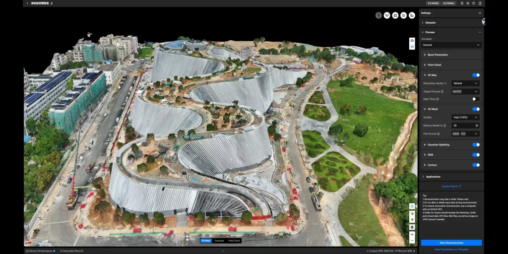
Software Designed for Industries
Specs Sheet
Aircraft
| Category | Specification |
| Takeoff Weight | 2239 g (with propellers) |
| Max Takeoff Weight | 2639 g |
| Max Payload | 400 g |
| Dimensions | Unfolded: 408 × 507 × 191 mm Folded: 335 × 155 × 203 mm |
| Diagonal Wheelbase | 572 mm |
| Propeller Size | 14.2 inches |
| Flight Speeds | Ascent: 10 m/s Descent: 8 m/s Horizontal: 23 m/s (Sport mode) |
| Max Takeoff Altitude | 7000 m (4500 m with accessories) |
| Max Flight Time | 59 minutes |
| Max Hover Time | 54 minutes |
| Max Flight Distance | 45 km |
| Max Wind Speed Resistance | 12 m/s |
| Operating Temperature | -20 °C to 50 °C |
| GNSS | GPS + Galileo + BeiDou + GLONASS + QZSS |
| RTK GNSS Accuracy | Horizontal: 1 cm + 1 ppm Vertical: 1.5 cm + 1 ppm |
| Ports | 3 × E-Port (official and third-party accessories) |
| Ingress Protection | IP55 |
Takeoff Weight
2239 g (with propellers)
Max Takeoff Weight
2639 g
Max Payload
400 g
Dimensions
Unfolded: 408 × 507 × 191 mm
Folded: 335 × 155 × 203 mm
Folded: 335 × 155 × 203 mm
Diagonal Wheelbase
572 mm
Propeller Size
14.2 inches
Flight Speeds
Ascent: 10 m/s
Descent: 8 m/s
Horizontal: 23 m/s (Sport mode)
Descent: 8 m/s
Horizontal: 23 m/s (Sport mode)
Max Takeoff Altitude
7000 m (4500 m with accessories)
Max Flight Time
59 minutes
Max Hover Time
54 minutes
Max Flight Distance
45 km
Max Wind Speed Resistance
12 m/s
Operating Temperature
-20 °C to 50 °C
GNSS
GPS + Galileo + BeiDou + GLONASS + QZSS
RTK GNSS Accuracy
Horizontal: 1 cm + 1 ppm
Vertical: 1.5 cm + 1 ppm
Vertical: 1.5 cm + 1 ppm
Ports
3 × E-Port (official and third-party accessories)
Ingress Protection
IP55
Cameras
| Category | Specification |
| Wide Camera | 1/0.98″ CMOS, 50 MP, 85.7° DFOV, 23.5 mm equiv., f/1.8 |
| Medium Tele Camera | 1/1.28″ CMOS, 50 MP, 35° DFOV, 70 mm equiv., f/2.88 |
| Tele Camera | 1/1.5″ CMOS, 50 MP, 9.7° DFOV, 252 mm equiv., f/2.8; 16× digital, 176× hybrid zoom |
| ISO Range | 100 to 25600 (normal); up to 1,638,400 (night scene) |
| Shutter Speed | 2 s to 1/8000 s |
| Max Photo Size | 8192 × 6144 |
| Video | H.265; 4K 3840×2160@30fps, FHD 1920×1080@30fps; 40 Mbps |
| Photo Format | JPEG / DNG (RAW) |
| NIR Auxiliary Light | FOV 5.2° to 6.6° |
| Laser Rangefinder | 3000 m (normal incidence); 1200 m (oblique); Class 1 eye-safe |
Wide Camera
1/0.98″ CMOS, 50 MP, 85.7° DFOV, 23.5 mm equiv., f/1.8
Medium Tele Camera
1/1.28″ CMOS, 50 MP, 35° DFOV, 70 mm equiv., f/2.88
Tele Camera
1/1.5″ CMOS, 50 MP, 9.7° DFOV, 252 mm equiv., f/2.8; 16× digital, 176× hybrid zoom
ISO Range
100 to 25600 (normal); up to 1,638,400 (night scene)
Shutter Speed
2 s to 1/8000 s
Max Photo Size
8192 × 6144
Video
H.265; 4K 3840×2160@30fps, FHD 1920×1080@30fps; 40 Mbps
Photo Format
JPEG / DNG (RAW)
NIR Auxiliary Light
FOV 5.2° to 6.6°
Laser Rangefinder
3000 m (normal incidence); 1200 m (oblique); Class 1 eye-safe
Infrared Thermal Camera
| Category | Specification |
| Thermal Imager | Uncooled VOx, 8 μm pixel pitch |
| Resolution | 1280 × 1024 (2560 × 2048 with UHR Infrared Image) |
| Lens | 45° DFOV, 53 mm equiv., f/0.85 |
| Sensitivity (NETD) | ≤50 mK @ f/1.0 |
| Temperature Range | High gain: -20 °C to 150 °C Low gain: 0 °C to 550 °C |
| Measurement Accuracy | High gain: ±2 °C or ±2% Low gain: ±5 °C or ±3% |
| Digital Zoom | 32× |
| Photo Format | JPEG, R-JPEG (16-bit) |
Thermal Imager
Uncooled VOx, 8 μm pixel pitch
Resolution
1280 × 1024 (2560 × 2048 with UHR Infrared Image)
Lens
45° DFOV, 53 mm equiv., f/0.85
Sensitivity (NETD)
≤50 mK @ f/1.0
Temperature Range
High gain: -20 °C to 150 °C
Low gain: 0 °C to 550 °C
Low gain: 0 °C to 550 °C
Measurement Accuracy
High gain: ±2 °C or ±2%
Low gain: ±5 °C or ±3%
Low gain: ±5 °C or ±3%
Digital Zoom
32×
Photo Format
JPEG, R-JPEG (16-bit)
Gimbal
| Category | Specification |
| Stabilisation | 3-axis (tilt, roll, pan) |
| Controllable Range | Tilt: -90° to +90° |
| Angular Vibration Range | ±0.007° |
Stabilisation
3-axis (tilt, roll, pan)
Controllable Range
Tilt: -90° to +90°
Angular Vibration Range
±0.007°
Sensing
| Category | Specification |
| Sensing Type | 6-directional fisheye vision, horizontal rotating LiDAR, 3-directional mmWave radar, downward ToF infrared |
| Rotating LiDAR | 110 m range; 360° horizontal, 59° vertical FOV; 250,000 to 460,000 pts/s; Class 1 |
| Power Line Detection (LiDAR) | Up to 32 m |
| mmWave Radar | Forward: 40 m Upward/Downward: 20 m (10 mm wire) |
| Obstacle Avoidance Speed | Up to 21 m/s (forward, backward, lateral) |
Sensing Type
6-directional fisheye vision, horizontal rotating LiDAR, 3-directional mmWave radar, downward ToF infrared
Rotating LiDAR
110 m range; 360° horizontal, 59° vertical FOV; 250,000 to 460,000 pts/s; Class 1
Power Line Detection (LiDAR)
Up to 32 m
mmWave Radar
Forward: 40 m
Upward/Downward: 20 m (10 mm wire)
Upward/Downward: 20 m (10 mm wire)
Obstacle Avoidance Speed
Up to 21 m/s (forward, backward, lateral)
Video Transmission
| Category | Specification |
| System | DJI O4 Enterprise Enhanced |
| Live View Quality | 3-channel 1080p@30fps |
| Max Transmission Distance | 40 km (IC); 20 km (CE/SRRC/MIC) Unobstructed, free of interference |
| Latency | 130 ms |
| Cellular | Two built-in DJI Cellular Dongle 2 modules (eSIM + nano-SIM) |
System
DJI O4 Enterprise Enhanced
Live View Quality
3-channel 1080p@30fps
Max Transmission Distance
40 km (IC); 20 km (CE/SRRC/MIC)
Unobstructed, free of interference
Unobstructed, free of interference
Latency
130 ms
Cellular
Two built-in DJI Cellular Dongle 2 modules (eSIM + nano-SIM)
Battery & Charging
| Category | Specification |
| Battery | 10073 mAh, 21.36 V, 215.2 Wh, Li-ion 6S, 768 g |
| Cycle Count | 200 |
| Low-Temperature Charging | Self-heating supported |
| Power Adapter | 515 W |
| Charging Hub | Sequential charging of three batteries; Standard (100%) and Standby (95%) modes |
Battery
10073 mAh, 21.36 V, 215.2 Wh, Li-ion 6S, 768 g
Cycle Count
200
Low-Temperature Charging
Self-heating supported
Power Adapter
515 W
Charging Hub
Sequential charging of three batteries; Standard (100%) and Standby (95%) modes
DJI RC Plus 3 Enterprise
| Category | Specification |
| Screen | 7.44 inches, 1920 × 1440, 2000 nits |
| Built-in Battery | 6933 mAh (99.01 Wh) |
| Weight | 1240 g |
| Interfaces | HDMI 1.4, SD 3.0, nano-SIM, USB-C, E-Port |
| Ingress Protection | IP54 |
Screen
7.44 inches, 1920 × 1440, 2000 nits
Built-in Battery
6933 mAh (99.01 Wh)
Weight
1240 g
Interfaces
HDMI 1.4, SD 3.0, nano-SIM, USB-C, E-Port
Ingress Protection
IP54
Accessories (Optional)
| Category | Specification |
| AL2 SpotLight | 60 W; 175 g; flood and spot modes; IP55 |
| AS2 Speaker | 35 W; 120 dB @ 1 m; 400 m broadcast distance; 194 g; IP55 |
AL2 SpotLight
60 W; 175 g; flood and spot modes; IP55
AS2 Speaker
35 W; 120 dB @ 1 m; 400 m broadcast distance; 194 g; IP55
Get In Touch
Have questions? Our drone experts are here to help