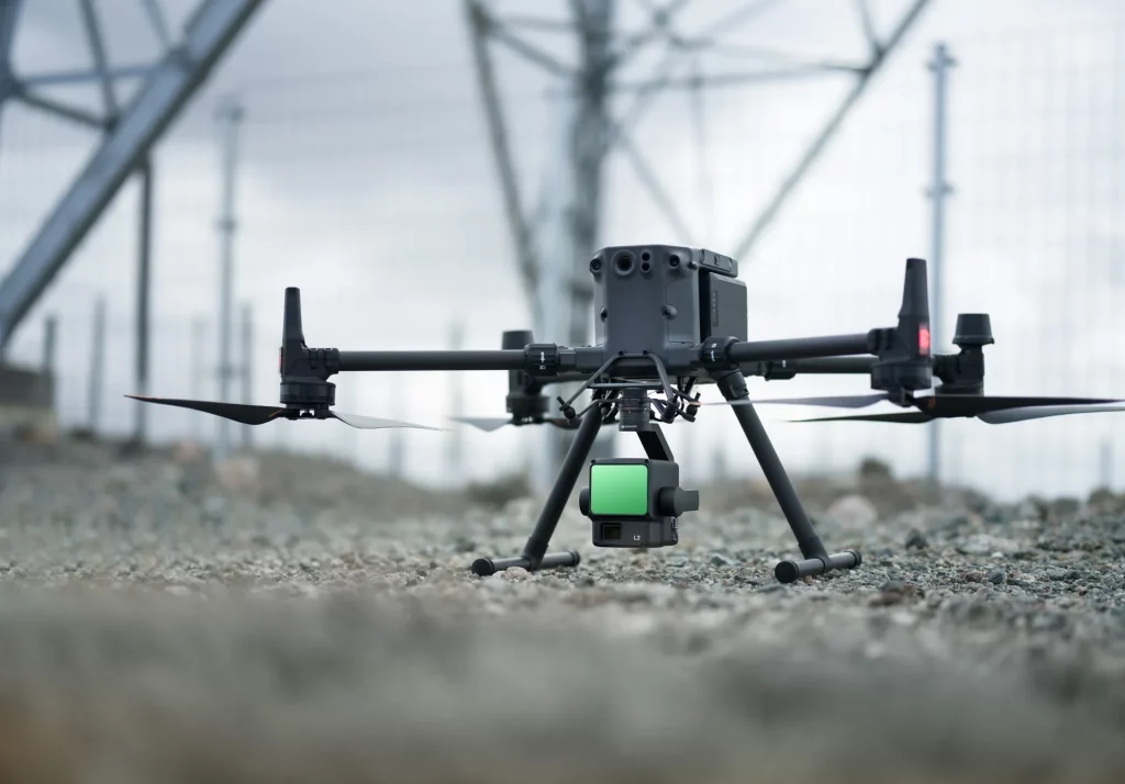
DJI Zenmuse L2
High‑Precision Aerial LiDAR & RGB Mapping Payload
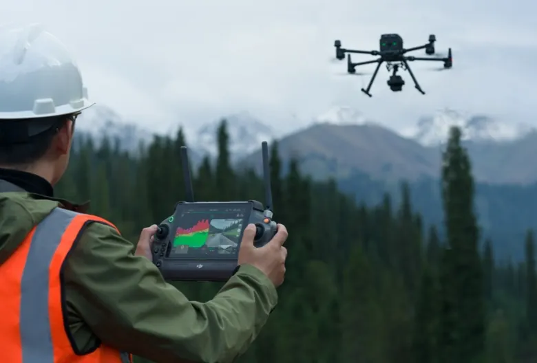
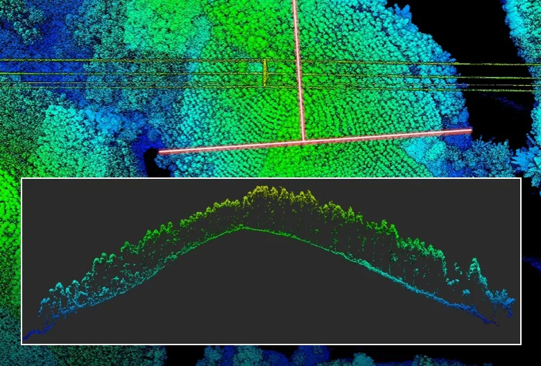
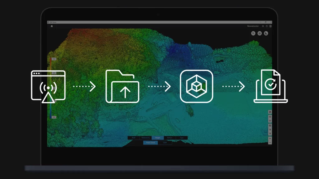
The Zenmuse L2 integrates a high‑accuracy LiDAR module, a self‑developed IMU, and a 4/3 CMOS RGB mapping camera into a single gimbal payload. It delivers centimeter‑level precision for surveying, mapping, and inspection tasks, even in complex terrain or dense vegetation. With seamless compatibility on the Matrice 350 RTK and streamlined workflows in DJI Terra, the L2 enables efficient end‑to‑end aerial data acquisition.
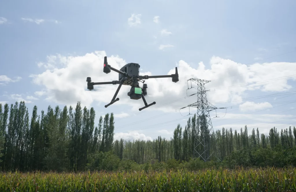
Built for professional geospatial applications, the Zenmuse L2 captures dense, accurate point clouds and high‑resolution imagery in a single flight. Its IP54‑rated design ensures reliability in challenging environments, while the no‑warm‑up IMU and optimized laser system reduce downtime and maximize efficiency. From infrastructure monitoring to forestry and power line inspection, the L2 provides a dependable solution for precise, repeatable results.
Exceptional Visual Clarity in Any Condition
Precision Distance Measurement
High‑Accuracy IMU System
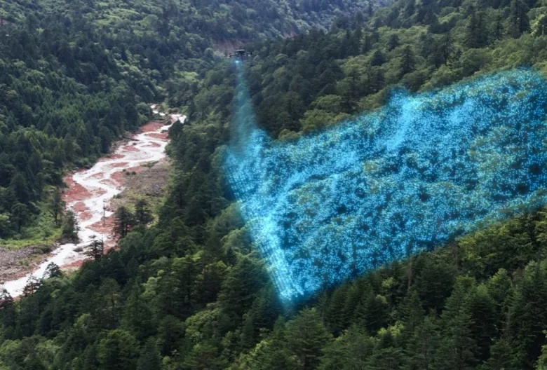
Efficient Data Acquisition
AI & Smart Features
| Category | Specification |
| Product Name | Zenmuse L2 |
| Dimensions | 155 × 128 × 176 mm (L×W×H) |
| Weight | 905 ± 5 g |
| Power | 28 W (typical), 58 W (max.) |
| IP Rating | IP54 |
| Supported Aircraft | Matrice 400, Matrice 350 RTK, Matrice 300 RTK (requires DJI RC Plus) |
| Storage Temperature | –20 °C to 60 °C (–4 °F to 140 °F) |
| Operating Temperature | –20 °C to 50 °C (–4 °F to 122 °F) |
| Category | Specification |
| Detection Range | 450 m @ 50% reflectivity, 0 klx 250 m @ 10% reflectivity, 100 klx Max: 500 m |
| Point Cloud Rate | Single return: max. 240,000 pts/s Multiple returns: max. 1,200,000 pts/s |
| System Accuracy | Horizontal: 5 cm @ 150 m Vertical: 4 cm @ 150 m |
| Real‑Time Point Cloud Coloring | Reflectivity, Height, Distance, RGB |
250 m @ 10% reflectivity, 100 klx
Max: 500 m
Multiple returns: max. 1,200,000 pts/s
Vertical: 4 cm @ 150 m
| Category | Specification |
| Ranging Accuracy (RMS 1σ) | 2 cm @ 150 m |
| Maximum Returns Supported | 5 |
| Scanning Modes | Non‑repetitive, Repetitive |
| FOV | Repetitive: H 70°, V 3° Non‑repetitive: H 70°, V 75° |
| Minimum Detection Range | 3 m |
| Laser Beam Divergence | H 0.2 mrad, V 0.6 mrad |
| Laser Wavelength | 905 nm |
| Laser Spot Size | H 4 cm, V 12 cm @ 100 m (FWHM) |
| Laser Pulse Emission Frequency | 240 kHz |
| Laser Safety | Class 1 (IEC 60825‑1:2014) |
| Accessible Emission Limit (AEL) | 233.59 nJ |
| Reference Aperture | Effective 23.85 mm (equivalent circular) |
| Max Laser Pulse Emission Power (5 ns) | 46.718 W |
Non‑repetitive: H 70°, V 75°
| Category | Specification |
| IMU Update Frequency | 200 Hz |
| Accelerometer Range | ±6 g |
| Angular Velocity Range | ±300 dps |
| Horizontal Positioning Accuracy | RTK FIX: 1 cm + 1 ppm |
| Vertical Positioning Accuracy | RTK FIX: 1.5 cm + 1 ppm |
| Category | Specification |
| Sensor | 4/3 CMOS, 20 MP effective pixels |
| Lens | FOV 84°, 24 mm equivalent, f/2.8–f/11, autofocus 1 m–∞ |
| Shutter Speed | Mechanical: 2–1/2000 s Electronic: 2–1/8000 s |
| Shutter Count | 200,000 |
| Photo Size | 5280 × 3956 (4:3) |
| Still Photography Modes | Single 20 MP Timed 20 MP JPEG Interval: 0.7–60 s RAW/JPEG+RAW Interval: 2–60 s |
| Video Codec & Resolution | H.264/H.265 4K: 3840×2160 @30fps FHD: 1920×1080 @30fps |
| ISO | Video: 100–6400 Photo: 100–6400 |
| Video Bitrate | 4K: 85 Mbps FHD: 30 Mbps |
| File System | exFAT |
| Photo Format | JPEG, DNG (RAW) |
| Video Format | MP4 (MPEG-4 AVC/H.264 or HEVC/H.265) |
24 mm equivalent,
f/2.8–f/11,
autofocus 1 m–∞
Electronic: 2–1/8000 s
Timed 20 MP
JPEG Interval: 0.7–60 s
RAW/JPEG+RAW Interval: 2–60 s
4K: 3840×2160 @30fps
FHD: 1920×1080 @30fps
Photo: 100–6400
FHD: 30 Mbps
| Category | Specification |
| Raw Data Storage | Photo / IMU / Point cloud / GNSS / Calibration files |
| Point Cloud Data Storage | Real‑time modeling data |
| Supported microSD | UHS‑I U3, ≥50 MB/s write, up to 256 GB |
| Recommended Cards | Lexar 1066x 64/128/256 GB U3 A2 V30 Kingston Canvas Go! Plus 128 GB U3 A2 V30 |
Kingston Canvas Go! Plus 128 GB U3 A2 V30
| Category | Specification |
| Supported Software | DJI Terra |
| Export Formats | PNTS, LAS, PLY, PCD, S3MB |
Get In Touch
Have questions? Our drone experts are here to help