Reach RS2 gets a fixed solution in just seconds and maintains robust performance even in challenging conditions. Centimeter accuracy can be achieved on distances up to 60 km in RTK, and 100 km in PPK mode.
GPS, GLONASS, BeiDou,Galileo, and QZSS
L1OF, L2OF, L1C/A, L2C,E1B/C, E5b, B1I B2I
PPP Support
RINEX raw data logs are compatible with PPP services so you can now get centimeter-precise results in any place on Earth. Process RINEX files in an online service and get position with absolute accuracy.
Built-in 3.5G modem
Reach RS2 features a power-efficient 3.5G HSPA modem with 2G fallback and global coverage. Now corrections can be accessed or broadcasted over NTRIP independently, without relying on Internet connection on your phone.
22 hours on 1 charge
Up to 22 hours of autonomous work when logging data and up to 16 hours as a 3G rover, even in cold weather—no more need to carry spare batteries with you. Reach RS2 can charge from a USB wall charger or a power bank over USB-C.
Gets a fix in seconds
Reach RS2 gets a fixed solution in just seconds and maintains robust performance even in challenging conditions. Centimeter accuracy can be achieved on distances up to 60 km in RTK, and 100 km in PPK mode.
GPS, GLONASS, BeiDou,Galileo, and QZSS
L1OF, L2OF, L1C/A, L2C,E1B/C, E5b, B1I B2I
PPP Support
RINEX raw data logs are compatible with PPP services so you can now get centimeter-precise results in any place on Earth. Process RINEX files in an online service and get position with absolute accuracy.
Built-in 3.5G modem
Reach RS2 features a power-efficient 3.5G HSPA modem with 2G fallback and global coverage. Now corrections can be accessed or broadcasted over NTRIP independently, without relying on Internet connection on your phone.
22 hours on 1 charge
Up to 22 hours of autonomous work when logging data and up to 16 hours as a 3G rover, even in cold weather—no more need to carry spare batteries with you. Reach RS2 can charge from a USB wall charger or a power bank over USB-C.
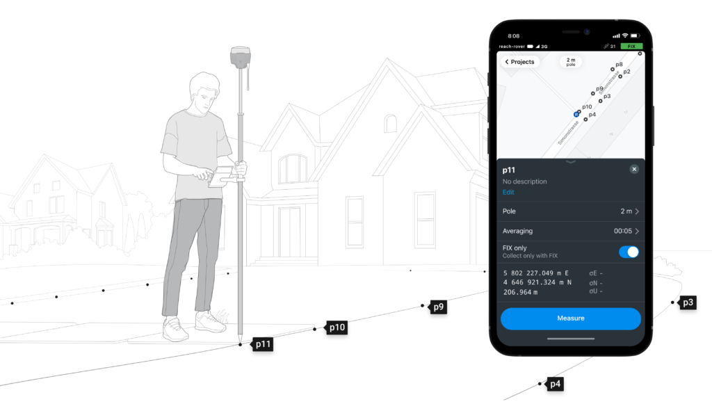
Surveying with ReachView 3
The easiest to use software for data collection that is available both for Android and iOS. With ReachView, you can collect and stakeout points and control all the features of Reach receivers, such as setting up a base station, logging RINEX data, and configuring NMEA output.
Point collection:
save points, and export data to CSV
Record each position as a point with centimeter precise coordinates. Export projects and open them in GIS or CAD software like AutoCAD, ArcGIS, QGIS, and others.
Coordinate systems based on
WGS84, NAD83, GDA2020, and others
Stakeout:
find point's position on the ground
Stakeout is used to find exact physical locations of points. They can be collected in ReachView or imported from other CAD or GIS software.
Logging in RINEX:
record raw data, position, and base correction logs
Record raw data, position and base correction logs. Point collection and recording of RAW data are independent processes and can be used simultaneously. ReachView has a simple and intuitive interface for logging configuration and control. We provide our version of RTKLib for PPK. It’s free and can be downloaded from our docs.
16 GB
Storage
160+ Days
of logging at 1 Hz
Connectivity
Real-time position streaming in NMEA
Reach provides data in standard NMEA that is used by most GIS apps. Simply connect your device to Reach over Bluetooth or with a cable, and turn on “Position output” in ReachView.
Compatible Apps
MachineryGuide, AgriBus-Navi, Efarmer, Agripilot, and others
Reach can turn on and off automatically
Reach provides data in standard NMEA that is used by most GIS apps. Simply connect your device to Reach over Bluetooth or with a cable, and turn on “Position output” in ReachView.
Position streaming
Interfaces
RS-232, TCP, Bluetooth
NTRIP or another Reach
as a base station
Reach RS2 needs a base station as a source of corrections. That’s a requirement for centimeter accuracy in RTK and PPK. Base might be either another Reach RS2 receiver or an NTRIP service. VRS is also supported.
Reach RS2 works seamlessly with other Reach receivers over any link.
Input and output corrections
Interfaces
TCP, LoRa, Bluetooth, RS-232, NTRIP
Formats
RTCM3
Max distance from a base
Over 60 km in RTK 100 km in PPK Any place on Earth with PPP
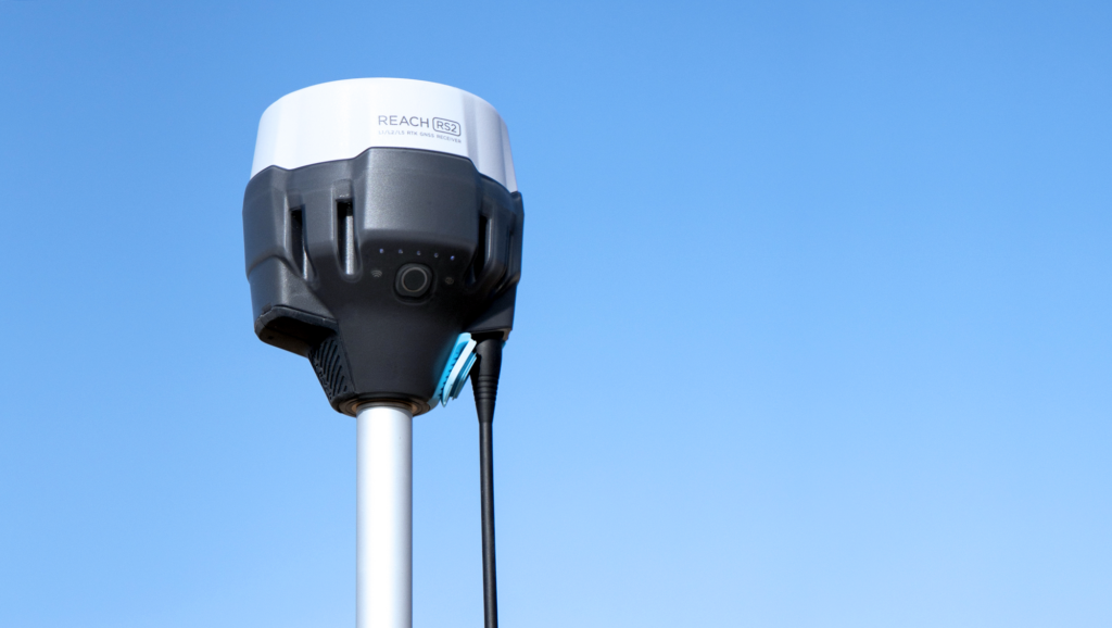
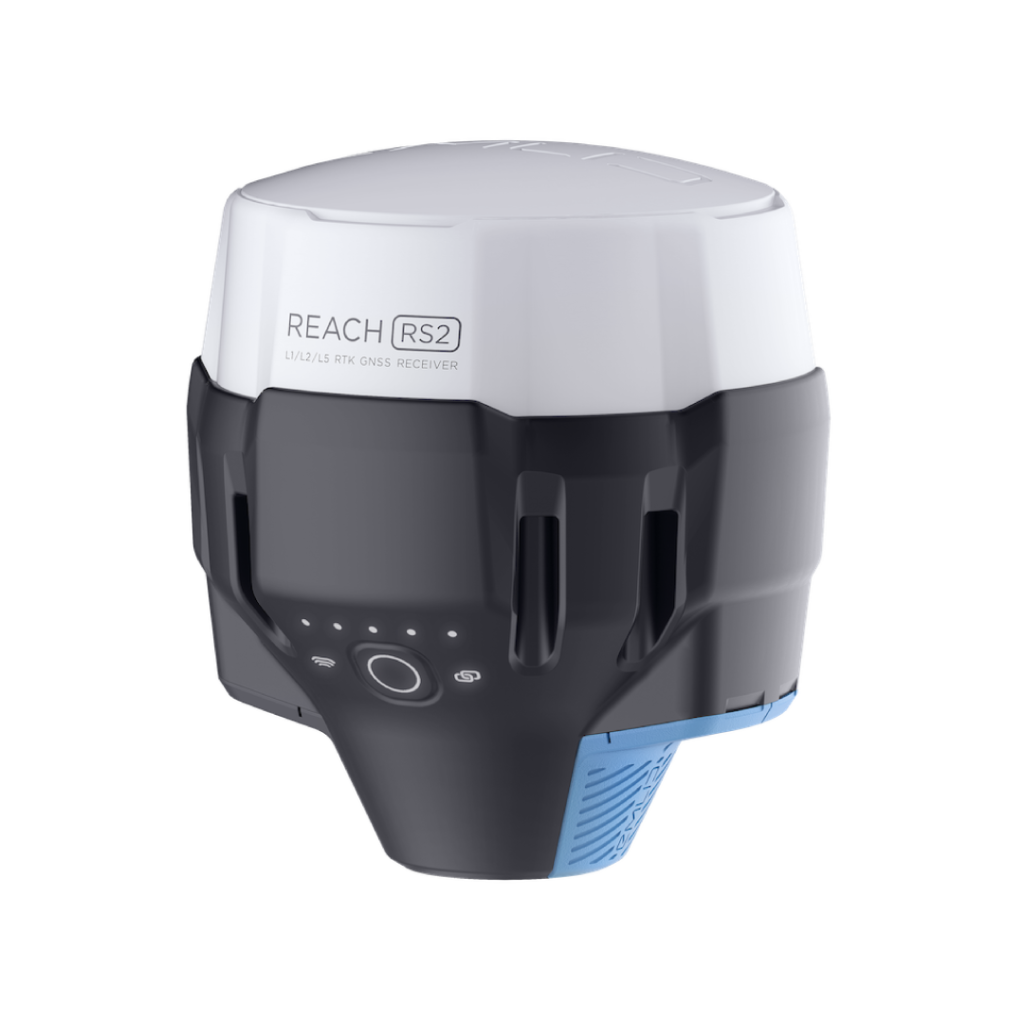
REACH RS2
Local Use Case: Point collection for RTK-based UAV point-to-point spraying with the Reach RS2
Point collection of young palm trees at an oil palm estate in south Selangor, Malaysia.