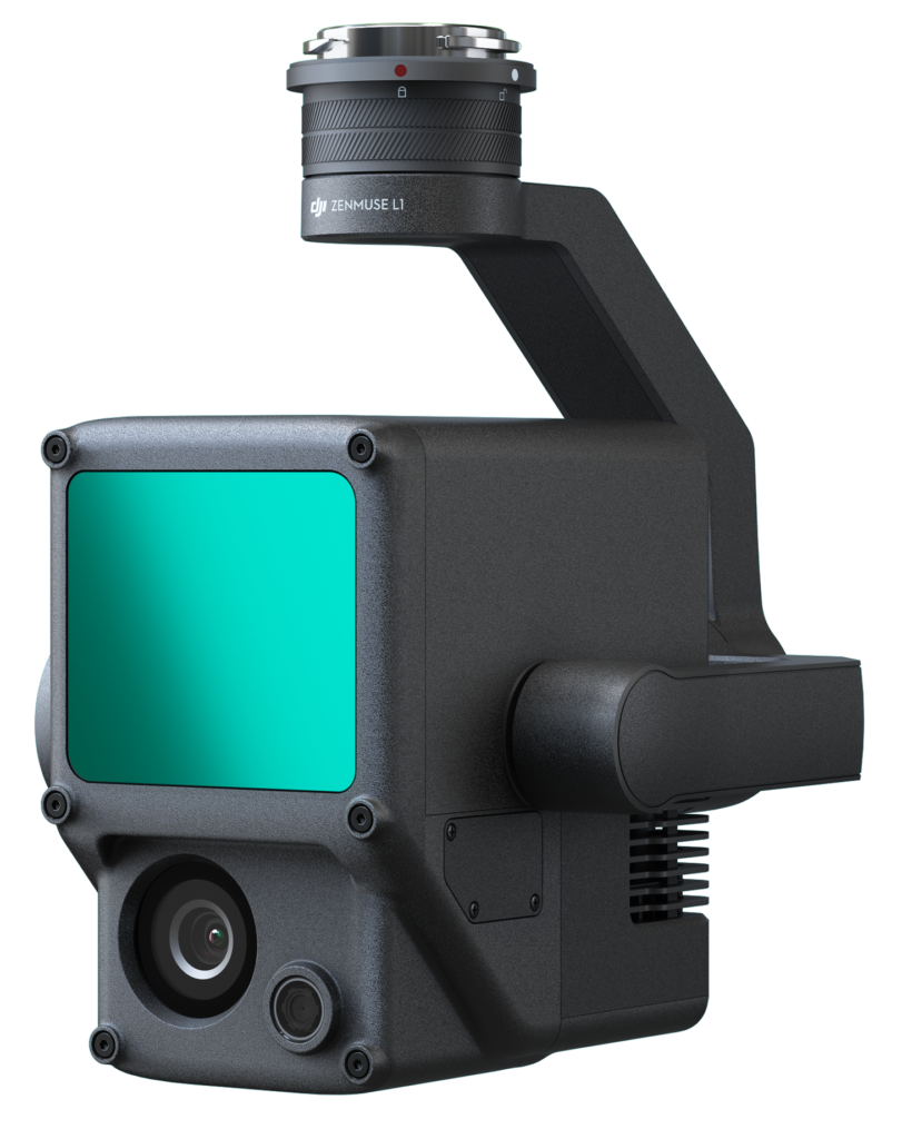
A LIDAR + RGB Solution for Aerial Surveying
Zenmuse L1 คือการนำ โมดูล Livox Lidar ซึ่งมีค่าความแม่นยำของ IMU ที่สูง พร้อมกล้อง CMOS ขนาด 1นิ้วบน gimbalที่มีความเถียรถึงสามแกน เมื่อใช้งานร่วมกับ Matrice 300 RTK และ DJI Terra L1 จะให้ผลลัพธ์ที่น่าอัศจรรย์จากความสามารถในการให้ข้อมูล 3 มิติแบบเรียลไทม์ เก็บรายละเอียดของโครงสร้างที่ซับซ้อนได้อย่างมีประสิทธิภาพเพื่อการสร้างแบบจำลองที่มีความแม่นยำสูง

Features
Integrates a Lidar module, an RGB camera, and a high-accuracy IMU
ครอบคลุมพื้นที่กว่า 2 กม. ในเที่ยวบินเดียว
ความแม่นยำในทางดิ่ง: 5 ซม. / ความแม่นยำในทางราบ: 10 ซม.
อัตราการวัดจุดสูงถึง 240,000 จุด ต่อวินาที
Supports 3 Returns
Detection Range: 450 m (80% reflectivity, 0 klx)
IP54 Ingress Protection Level
Point Cloud LiveView
ออกจากขีดจำกัดเดิมๆของการทำแผนที่

Exceptional Efficiency

Unparalleled Accuracy
Render centimeter-accurate reconstructions thanks to the high-accuracy IMU, a vision sensor for positioning accuracy, and the incorporation of GNSS data.

พร้อมบินในทุกสถานะการ
The IP54 rating allows the L1 to be operated in rainy or foggy environments. The Lidar module’s active scanning method enables you to fly at night.

Visualize Data as You Fly
Livox Lidar Module

เก็บรายละเอียดทุกอย่าง
RGB Camera

Accurate Details
High-accuracy IMU
Recreate the World in 3D Point Clouds
Point Cloud LiveView
Measurement and Annotation
ตรวจสอบและแสดงผลในหลากหลายรูปแบบ พร้อมตัววัดและคำอธิบายประกอบ

ตัวช่วยหลังการปฏิบัติการ
DJI Terra fuses the IMU and GNSS data for point cloud and visible light calculations, in addition to conducting POS data calculations so you can effortlessly generate reconstructed models and accuracy reports.
บทความที่เกี่ยวข้อง
Instant Clarity. Superior Accuracy.
Get In Touch
Have questions? Our drone experts are here to help


