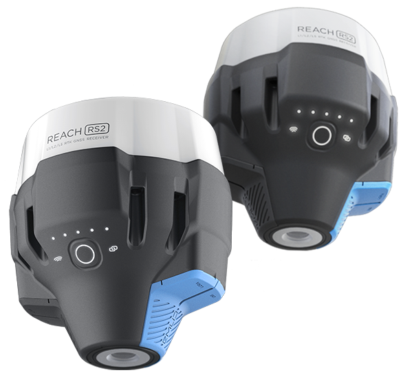
ตัวรับสัญญาณ RTK GNSS แบบหลายแบนด์พร้อมความแม่นยำระดับเซนติเมตร
ใช้สำหรับการสำรวจ การทำแผนที่ และการนำทาง
Mobile App included.
ระดับพื้นฐานสูงสุด 100 km
อัตราการอัปเดต 10 Hz
เครื่องรับสัญญาณ GNSS แบบหลายความถี่รับรอง ความแม่นยำระดับเซ็นติเมตร
For surveying, mapping and navigation. Mobile App included.
Baseline up to 100 km
Update rate 10 Hz

Gets a fix in seconds
Reach RS2 gets a fixed solution in just seconds and maintains robust performance even in challenging conditions. Centimeter accuracy can be achieved on distances up to 60 km in RTK, and 100 km in PPK mode.
GPS, GLONASS, BeiDou,Galileo, and QZSS
L1OF, L2OF, L1C/A, L2C,E1B/C, E5b, B1I B2I
PPP Support
RINEX raw data logs are compatible with PPP services so you can now get centimeter-precise results in any place on Earth. Process RINEX files in an online service and get position with absolute accuracy.
Built-in 3.5G modem
Reach RS2 features a power-efficient 3.5G HSPA modem with 2G fallback and global coverage. Now corrections can be accessed or broadcasted over NTRIP independently, without relying on Internet connection on your phone.
22 hours on 1 charge
Up to 22 hours of autonomous work when logging data and up to 16 hours as a 3G rover, even in cold weather—no more need to carry spare batteries with you. Reach RS2 can charge from a USB wall charger or a power bank over USB-C.
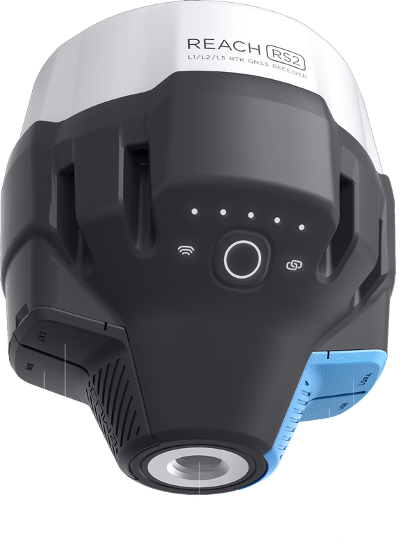
Gets a fix in seconds
Reach RS2 gets a fixed solution in just seconds and maintains robust performance even in challenging conditions. Centimeter accuracy can be achieved on distances up to 60 km in RTK, and 100 km in PPK mode.
GPS, GLONASS, BeiDou,Galileo, and QZSS
L1OF, L2OF, L1C/A, L2C,E1B/C, E5b, B1I B2I
PPP Support
RINEX raw data logs are compatible with PPP services so you can now get centimeter-precise results in any place on Earth. Process RINEX files in an online service and get position with absolute accuracy.
Built-in 3.5G modem
Reach RS2 มีโมเด็ม 3.5G HSPA ที่ประหยัดพลังงานรองรับระบบ 2G ที่ครอบคลุมพื้นที่ทั่วโลก ขณะนี้การแก้ไขสามารถเข้าถึงหรือถ่ายทอดผ่าน NTRIP ได้อย่างอิสระโดยไม่ต้องอาศัยการเชื่อมต่ออินเทอร์เน็ตบนโทรศัพท์ของคุณ
22 hours on 1 charge
ทำงานอัตโนมัติสูงสุด 22 ชั่วโมงเมื่อบันทึกข้อมูล และใช้งานนานถึง 16 ชั่วโมงเท่ากับ 3G rover ทำงานได้ในทุกสภาวะอากาศ ไม่จำเป็นต้องพกแบตเตอรี่สำรองติดตัวอีกต่อไป Reach RS2 สามารถชาร์จจากที่ชาร์จ USB หรือพาวเวอร์แบงค์ผ่าน USB-C

การสำรวจทำได้ง่ายๆด้วย ReachView 3
การสำรวจพื้นที่ง่ายๆ ด้วย ReachView 3 ซอฟต์แวร์ที่ใช้งานง่ายและเหมาะต่อการใช้งานรว่มกันทั้ง Android และ IOS ผู้ใช้สามารถ มาร์กจุดและปรับแต่งการแสดงผลของเครื่องได้ รวมทั้งตั้งค่าสถานีบันทึกข้อมูล RINEX พร้อมกำหนดเอาต์พุต NMEA
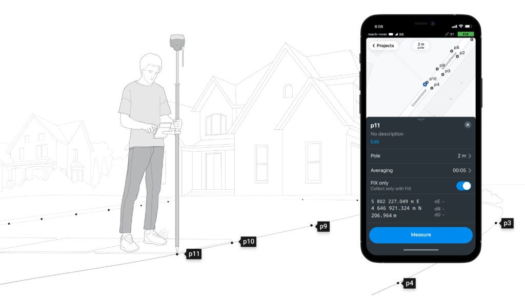
Point collection: save points, and export data to CSV
บันทึกพิกัดแต่ละจุดได้อย่างแม่นยำระดับเซ็นติเมตร ซึ่งสามารถส่งออกข้อมูลไปยังซอฟต์แวร์ GIS หรือ CAD ได้ เช่น AutoCAD, ArcGis, QGIS
Coordinate systems based on
WGS84, NAD83, GDA2020, and others
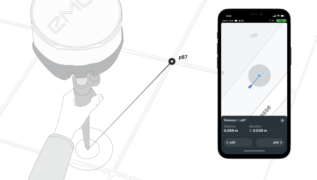
Stakeout: find point's position on the ground
การวางหลักเขต ถูกใช้เพื่อค้นหาตำแหน่งทางภาคพื้นดินที่แม่นยำมากขึ้น ซึ่งสามมารถประมวลผลจาก ReachView หรือนำเข้าข้อมูลจากซอฟต์แวร์ CAD หรือ GIS
การเข้าสู่ระบบ RINEX: บันทึกข้อมูลดิบ ตำแหน่ง และ Base correction logs
บันทึกข้อมูลดิบ ตำแหน่งและ Base correction logs ทำงานร่วมกับ ReachView ที่มีอินเทอร์เฟซที่เรียบง่ายเหมาะแก่การกำหนดค่าและควบคุมการบันทึกข้อมูล สามารถ
ดาวน์โหลด RTKLiB สำหรับ PPK ได้ฟรีจากไฟล์เอกสารของเรา
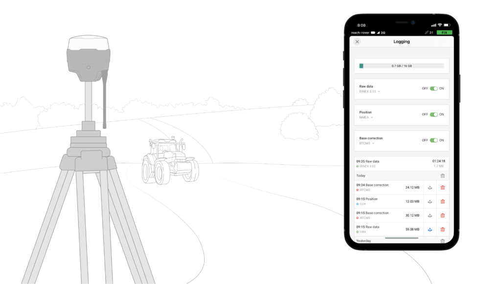
16 GB
Storage
160+ Days
of logging at 1 Hz
Connectivity
สตรีมตำแหน่งแบบเรียลไทม์ผ่าน NMEA
Reach ประมวลข้อมูลที่ได้มาตรฐาน NMEA ซึ่งสามารถทำงานคู่กับ แอพพลิเคชั่น GIS ทั่วไป เชื่อมต่อง่ายๆผ่านบรูทูธ หรือสายเคเบิลทั่วไป จากนั้นเปิด “Position output” ใน ReachView
Compatible Apps
MachineryGuide, AgriBus-Navi, Efarmer, Agripilot, and others
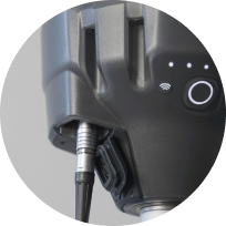
Reach can turn on and off automatically
Reach provides data in standard NMEA that is used by most GIS apps. Simply connect your device to Reach over Bluetooth or with a cable, and turn on “Position output” in ReachView.Reach provides data in standard NMEA that is used by most GIS apps. Simply connect your device to Reach over Bluetooth or with a cable, and turn on “Position output” in ReachView.
Position streaming
Interfaces
RS-232, TCP, Bluetooth
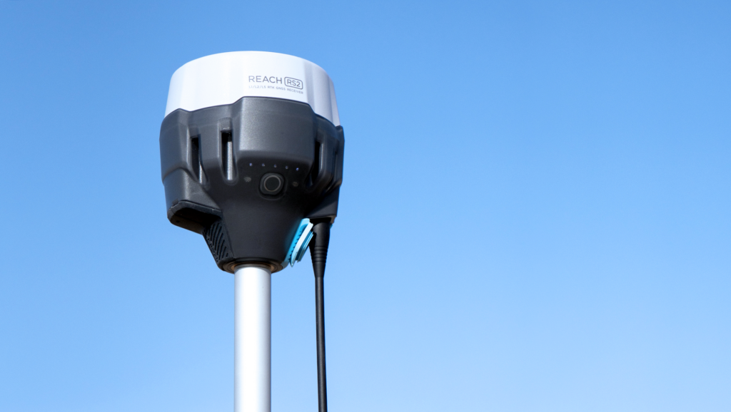
NTRIP หรือ REACH อีกตัวทำหน้าที่เป็นสถานีรับและส่งสัญญาณ
Reach R2s ต้องการ ตัวรับสัญญาณเพื่อ ตรวจสอบความถูกต้องของข้อมูล ซึ่งเป็นสิ่งจำเป็นสำหรับการประมวลผลระดับเซ็นติเมตรของ RTK และ PPK Reach RS+สามารถทำงานร่วมกับตัวรับสัญญาณตัวอื่นได้อย่างไร้ที่ติแต่ต้องเป็น Reach RS+ อีกตัว หรือ NTRIP VRS
Input and output corrections
Interfaces
TCP, LoRa, Bluetooth, RS-232, NTRIP
Formats
RTCM3
ระยะห่างสูงสุดจาก Station
Over 60 km in RTK
100 km in PPK
Any place on Earth with PPP
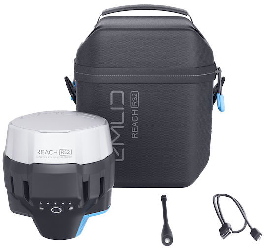
Comes with LoRa antenna, USB cable, and carrying case with a strap
Contact us to purchase the Emlid Reach RS2
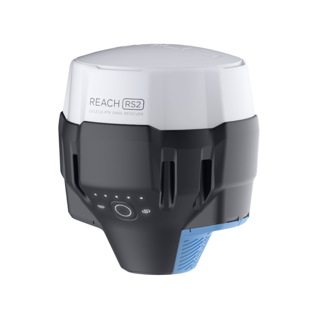
Standalone Reach RS2
1x Emlid Reach RS2
83,500 THB
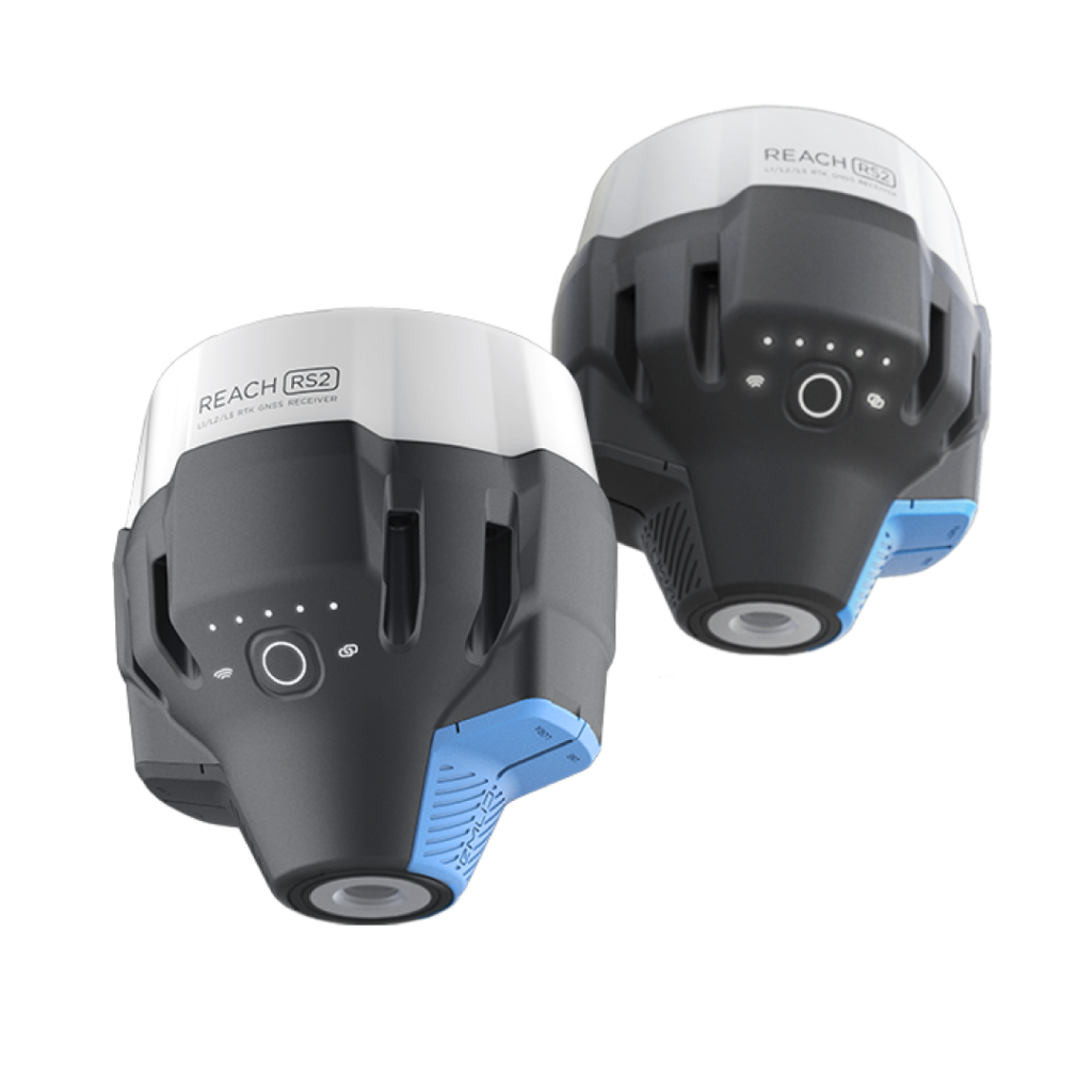
Survey Kit Reach RS2
2x Emlid Reach RS2
163,000 THB
Get In Touch
Have questions? Our drone experts are here to help


