What are RTK Drones
RTK, also known as Real-Time Kinematic, is an advanced surveying method widely employed by Global Navigation Satellite Systems (GNSS) and Global Positioning Systems (GPS) to enhance the precision of their receivers significantly. In contrast to standard satellite navigation systems, which offer positional accuracy of around two to four meters, RTK-capable systems can achieve an impressive accuracy that is about 100 times higher.
RTK-capable receivers utilize carrier-based ranging to deliver real-time positional corrections, achieving accuracy at the centimeter level. This process effectively corrects common errors in location data found in traditional GNSS/GPS systems. Depending on the sophistication of the RTK receiver, these precise corrections are provided at a frequency ranging from at least once per second to as frequent as 20 times per second.
While RTK drone has been employed in construction, agriculture, and survey & mapping for some time, its recent adaptation in conjunction with drone surveying has been groundbreaking. In essence, RTK technology corrects inaccuracies in the data captured during drone surveys. These enhancements result in significantly higher accuracy in the surveying results, making the process much more efficient than other traditional surveying methods.
How does RTK Drone function?
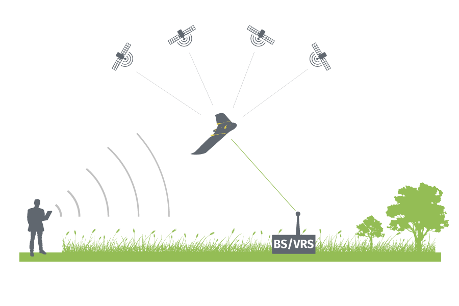
An RTK-enabled drone is equipped with a GNSS RTK receiver onboard, which collects data from both satellites and a stationary base (ground) station. This combination allows for real-time correction of image locations as the drone flies.
Satellite data alone is prone to errors caused by factors like tropospheric delays, limiting its maximum accuracy to approximately 1 meter (around 3.3 feet). However, incorporating data from a ground station helps correct these satellite signal errors, significantly improving accuracy to the centimeter-level range (sub-inch precision).
For RTK technology to function effectively, continuous and uninterrupted communication is necessary between the GNSS base station, the drone’s base station, and the drone itself. By maintaining this communication, when the drone lands, the data collected can be used for post-processing and mapping survey results with exceptional absolute accuracy, assuming all signals remained constant during the flight.
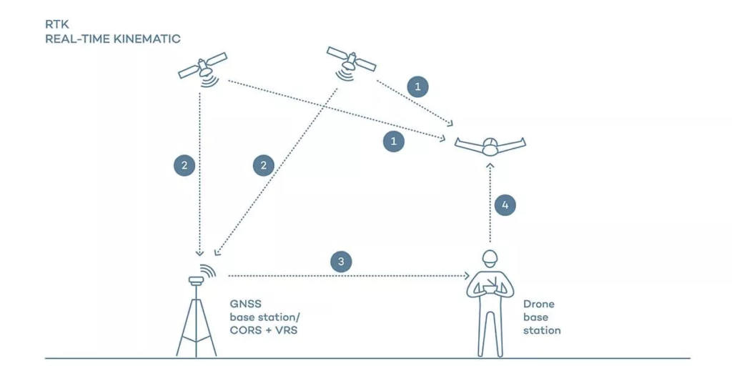
RTK drone relies on four continuous communication lines to rectify satellite location data:
1. Communication between satellites and the drone
2. Communication between satellites and the GNSS base station or CORS (Continuously Operating Reference Station) network (which may support Virtual Reference Station – VRS via mobile)
3. Communication between the GNSS base station or CORS/VRS and the drone base station
4. Communication between the drone base station and the drone itself.
While receiving corrected data during a flight might seem advantageous, real-world conditions introduce challenges. Obstacles can obstruct or interrupt signals, and flights may extend beyond a signal’s strength range, making RTK technology vulnerable in such scenarios.
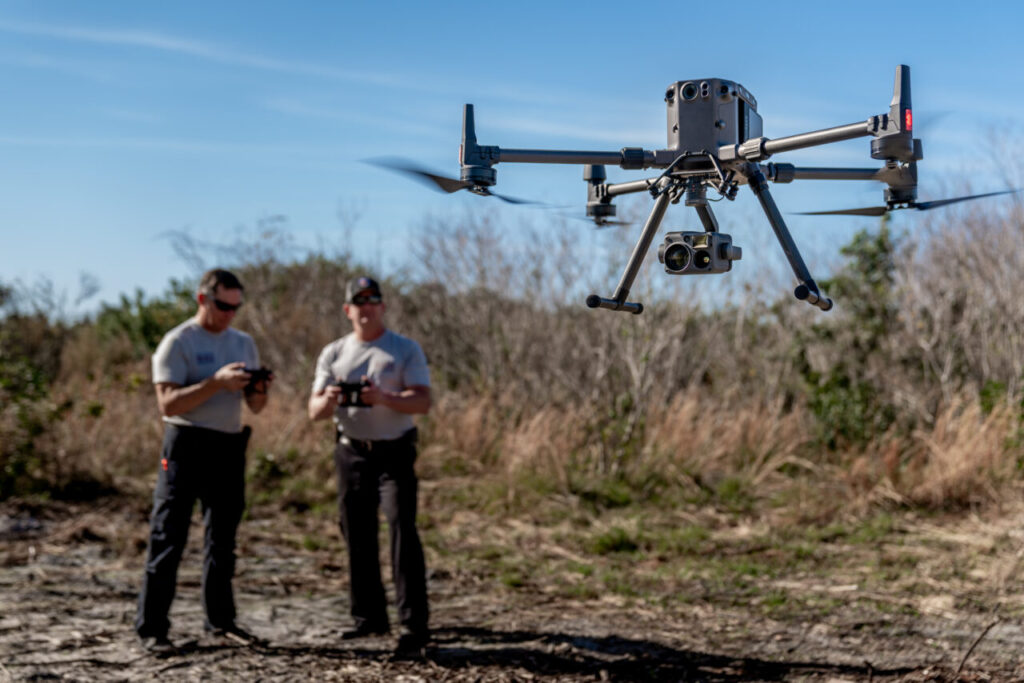
RTK Drones uses in Industries
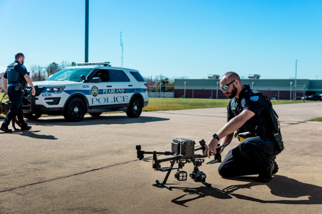
Public Safety
Numerous public safety organizations are progressively turning to UAVs to conduct vital operations, including tactical reconnaissance and documenting scenes. The integration of RTK-enabled drone systems further enhances the aerial capabilities of these agencies by delivering exceptionally precise positional data in real time to operators. This proves particularly advantageous for tasks such as creating detailed 2D and 3D maps of crime scenes, traffic accidents, managing emergencies in disaster zones, and other operations that demand accurate and comprehensive collection of location data. For example the use of drones during “Thai Cave Rescue” for a search and rescue mission to save the missing boys.
Farming
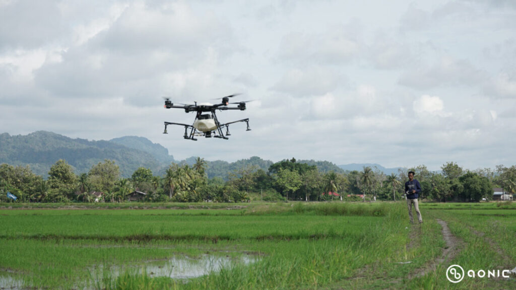
While farming might be commonly associated with manual labor, modern agriculture heavily relies on cutting-edge technology and automation. RTK technology plays a pivotal role in enabling contemporary farming practices. Beyond ensuring precise vegetation mapping, geological surveys, and agricultural inspections, RTK drones provide accurate location data, helping farmers make efficient decisions on seeding crop locations, as well as determining optimal positions for drainage and irrigation systems. Moreover, RTK facilitates the operation of self-driving tractors and other precision farming systems in the fields, eliminating the need for farmers to be physically present in the cab.
Surveying/Mapping
Surveying has been a practice since the human revolution, but it remains challenging to conduct in inaccessible areas worldwide. Luckily, the introduction of RTK technology has brought a significant revolution to this practice. With the help of RTK-capable drones, surveyors can now accurately survey and map even the most remote locations on the planet. This includes elevated mountainous regions characterized by rapidly changing and unpredictable weather conditions, as well as other hazardous environments. Importantly, these advanced drones enable surveyors to avoid putting themselves in harm’s way while achieving precise results.
Inspection
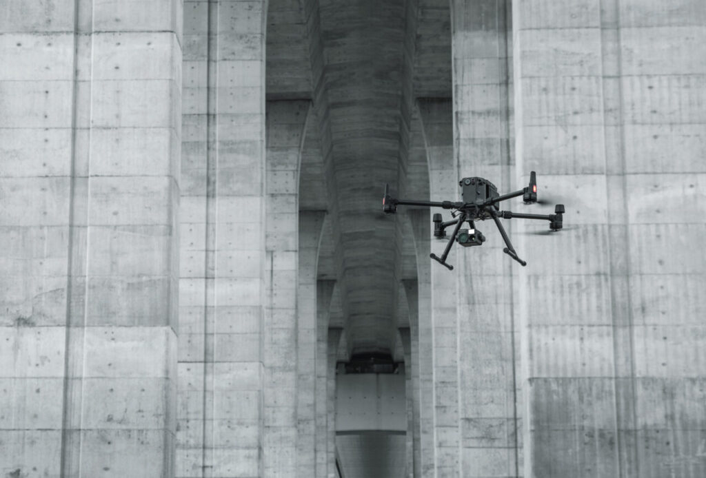
Integrating RTK technology into drone inspections enhances the safety and ease of remote operations. By utilizing RTK drones, inspectors can access real-time, highly accurate location data, allowing them to swiftly and precisely identify potential defects in facility equipment. This streamlined process facilitates efficient maintenance work and serves as a preventive measure against potential catastrophic failures.

Commercial RTK Drones
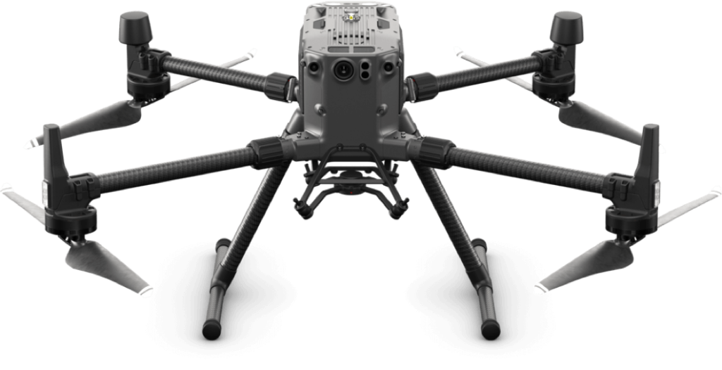
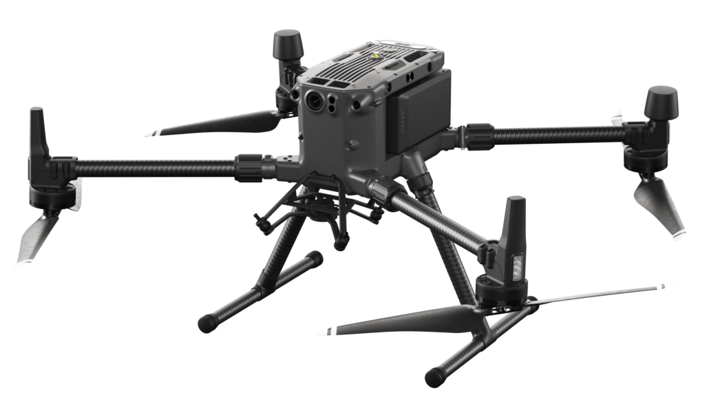 | DJI Matrice 350 RTK An upgraded flagship drone platform, the Matrice 350 RTK sets a new benchmark for the industry. This next-generation drone platform features an all-new video transmission system and control experience, a more efficient battery system, and more comprehensive safety features, as well as robust payload and expansion capabilities. It is fully powered to inject innovative strength into any aerial operation. |
 | DJI Matrice 300 RTK The DJI Matrice 300 RTK is the industry standard commercial drone platform that takes inspiration from modern aviation systems. Offering up to 55 minutes of flight time, advanced AI capabilities, 6 Directional Sensing & Positioning, and more, the M300 RTK sets a whole new standard by combining intelligence with high performance and unrivaled reliability. Known for its versatility, the M300 RTK works in conjunction with the Zenmuse series payloads. Execute missions that require custom complex integrations with DJI’s developer SDK. |
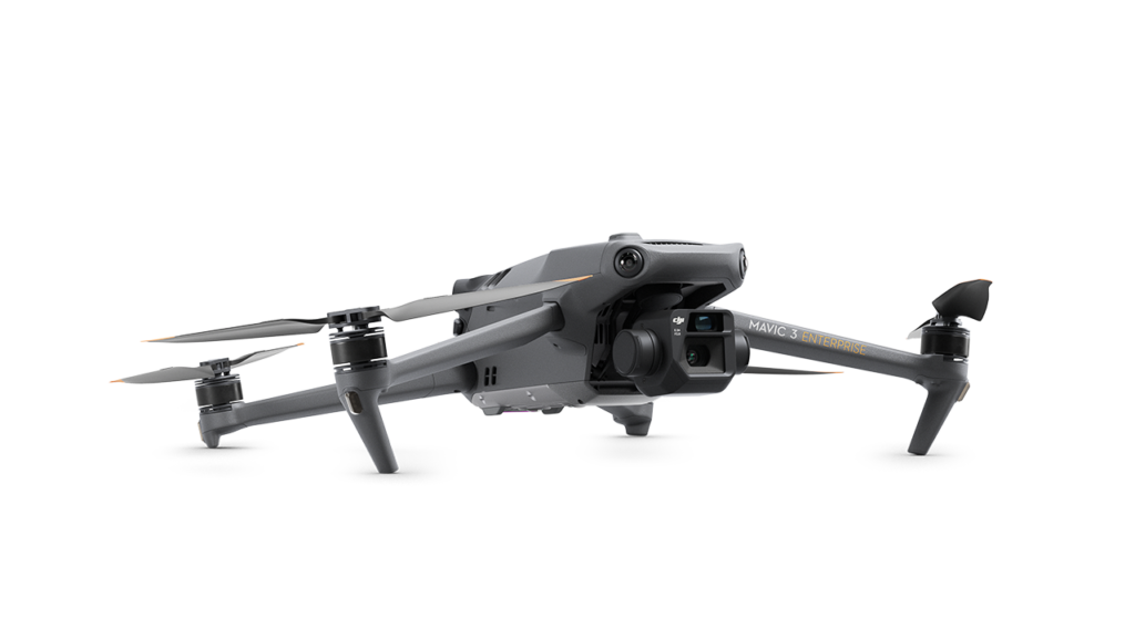 | DJI Mavic 3 Enterprise The DJI Mavic 3 Enterprise redefines industry standards for small commercial drones. With a mechanical shutter, a 56× zoom camera, and an RTK module for centimeter-level precision, the Mavic 3E brings mission efficiency to new heights. A thermal version is available for firefighting, search and rescue, inspection, and night operations. |
Conclusion
RTK technology has been a familiar term in the drone industry for some time. However, its importance remains significant, and there is a consistent demand for it as businesses opt for RTK-equipped drones to fulfill their needs in drone mapping and surveying. These RTK drones offer exceptional survey-grade precision, requiring minimal or even no ground control points. As a result, they significantly enhance mapping efficiency across various aspects.