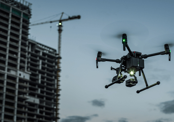
Introduction
In the ever-evolving landscape of agriculture, innovation is key to optimizing yields, reducing waste, and promoting sustainability. Drones, also known as Unmanned Aerial Vehicles (UAVs), have emerged as one of the most transformative technologies in modern farming practices. These aerial wonders are not only changing the way we approach agriculture but also opening up new possibilities for precision, efficiency, and data-driven decision-making. In this article, we delve into the world of drone usage in agriculture, exploring ten specific applications that are revolutionizing the industry.
Drone Usage in Agriculture
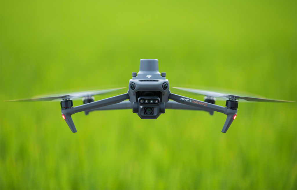
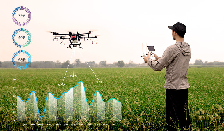
Drone usage in agriculture involves the deployment of unmanned aerial vehicles equipped with various sensors and cameras to collect data, monitor crops, and carry out tasks that enhance agricultural productivity and sustainability. These versatile devices have the ability to capture high-resolution imagery, analyze plant health, and provide valuable insights that empower farmers to make informed choices about their crops and land management practices.
5 Benefits of Drones in Agriculture
Before we delve into the diverse applications of drones in agriculture, it’s important to highlight the overarching benefits they bring to the field:
Precision Farming
UAVs are used in precision agriculture for a variety of tasks ranging from soil sample and crop field analysis to planting and pesticide application.
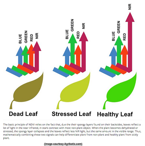
Drones in agriculture can be used in conjunction with a variety of imaging technologies such as hyperspectral, multispectral, thermal, and so on to provide farmers with temporal and site-specific information regarding crop health, fungal infections, growth bottlenecks, and so on.
UAVs are extremely useful for meticulously tracking vast swaths of agricultural land, taking into account features like as tilt and height, for example, to determine the most effective planting routine.
Importantly, the high-resolution resolution of drone data can be used to monitor crop fertility, allowing agronomists to apply fertilizers with greater precision, reduce waste, and construct or repair irrigation systems.
Cost Efficiency
One of the significant advantages of integrating drones into agriculture is their ability to contribute to cost efficiency. Drones play a pivotal role in minimizing input costs by detecting issues in the field at an early stage and enabling farmers to apply treatments precisely where they are needed. This targeted approach to resource utilization translates to significant savings in terms of water, fertilizers, pesticides, and labor.
In traditional farming practices, identifying problems like diseases, pests, or nutrient deficiencies often involves manual scouting or visual inspections. These methods can be time-consuming, labor-intensive, and sometimes ineffective in detecting issues before they escalate. Moreover, the conventional approach might lead to overcompensation, where treatments are applied uniformly across the entire field, even in areas that don’t require intervention.
Drones equipped with advanced sensors and cameras change this dynamic. As drones fly over the fields, their sensors can detect subtle changes in plant health, temperature variations, and signs of stress. For instance, multispectral cameras can capture wavelengths of light that are indicative of different plant conditions, including early signs of diseases or nutrient imbalances.
When drones identify potential problem areas, farmers can then target their treatments specifically to those areas. Instead of applying chemicals, water, or other interventions uniformly, farmers can focus their efforts on the areas that need attention the most. This precision not only ensures that treatments are effective but also reduces unnecessary resource use.
The result is a significant reduction in input costs. Unnecessary usage of water, fertilizers, and pesticides is minimized, leading to direct savings for farmers. Additionally, the reduced environmental impact, as fewer chemicals are released into the ecosystem, contributes to sustainable farming practices.
Time Savings
Drones, equipped with advanced navigation systems and sensors, are capable of covering vast agricultural landscapes in a fraction of the time it would take for humans to do the same task. Traditional field inspections involve walking, driving, or even flying in manned aircraft, all of which are considerably slower and more resource-intensive compared to the agility and efficiency of drones.
When a drone takes flight, it can cover substantial ground rapidly, capturing detailed imagery and data as it goes. This rapid coverage is particularly beneficial during critical growth stages, disease outbreaks, or adverse weather events. Drones can swiftly assess the overall health of crops, identify problem areas, and monitor changes, all without the need for manual labor.
Furthermore, the data collected by drones is available in real time, which is crucial for making informed decisions promptly. The ability to access up-to-date information about crop conditions, pest infestations, or soil moisture levels empowers farmers to take immediate action to address issues and implement necessary adjustments to their cultivation practices.
In the past, farmers might have had to spend hours or even days manually inspecting and assessing large fields, with the added challenge of potential human error. Drones eliminate this constraint by providing consistent, accurate, and real-time data without the inherent limitations of human observation.
Data-Driven Decision Making
By collecting comprehensive and real-time data, drones provide actionable insights into crop conditions, leading to enhanced yields and more sustainable resource management practices.
The process of data-driven decision making with drone-generated data starts with the precision and accuracy of the information collected. Drones traverse fields, capturing a wealth of data encompassing plant health indicators, growth patterns, temperature differentials, moisture content, and more. This raw data is then subjected to advanced analytics, transforming it into actionable insights that farmers can utilize effectively.
The true value of drone-collected data emerges in its ability to drive tangible actions. Farmers receive detailed reports, visualizations, and maps that pinpoint areas requiring attention, opportunities for optimization, and potential challenges. For instance, if a drone identifies a specific section of a field experiencing stress due to inadequate irrigation, farmers can adjust their irrigation schedules to target that area precisely, thereby conserving water and ensuring optimal growth conditions.
Moreover, the historic data archive created by drones provides a comprehensive view of trends and patterns over time. This long-term perspective allows farmers to make decisions based on a nuanced understanding of how variables like weather, soil conditions, and management strategies interact. Such insights enable informed choices for planting, pest management, and resource allocation across different seasons.
Environmental Sustainability
The concept of environmental sustainability revolves around the responsible management of resources to ensure their availability for future generations while minimizing negative impacts on ecosystems. Drones play a key role in this paradigm shift by addressing some of the major challenges faced by conventional agricultural practices.
One of the most tangible ways drones promote environmental sustainability is through targeted resource application. Traditional methods often involve blanket application of water, fertilizers, and pesticides, regardless of the specific needs of different areas within a field. This approach leads to wastage, potential contamination of water sources, and overuse of chemicals. Drones change this dynamic by allowing farmers to precisely target the application of these resources only where they are needed the most.
10 Drone Usage in Agriculture
Aerial Imaging and Mapping
Drones, armed with state-of-the-art cameras and sensors, have elevated the concept of aerial imaging and mapping to an unprecedented level. By capturing high-resolution imagery from above, drones are not only providing stunning visuals but are also creating detailed field maps and topographical models that revolutionize land management practices. These maps empower farmers with the ability to plan seeding patterns, irrigation layouts, and other practices with unparalleled accuracy.
At the heart of aerial imaging and mapping lies the capability of drones to capture imagery from vantage points that were previously inaccessible or required costly aerial surveys. Equipped with advanced cameras, including multispectral and high-resolution options, drones traverse fields with precision, collecting data that paints a comprehensive picture of the land below.
The images and data collected by drones are then processed to create intricate field maps and topographical models. These maps offer a bird’s-eye view of the entire landscape, highlighting variations in terrain, soil composition, and plant health. This level of detail is invaluable for farmers seeking to make informed decisions about their land management strategies.
One of the primary benefits of these detailed maps is the precision they bring to various agricultural practices. For instance, farmers can use these maps to plan seeding patterns that take into account variations in soil quality and drainage across their fields. By planting seeds in optimal locations, farmers can ensure uniform growth and maximize yields.
Similarly, irrigation layouts can be tailored to the topographical features of the land, ensuring that water is distributed efficiently and minimizing water wastage. This precision not only conserves water resources but also prevents overwatering, which can lead to soil erosion and nutrient leaching.
Beyond planting and irrigation, these maps aid in other crucial decisions such as the placement of drainage systems, the selection of optimal areas for pest control measures, and the design of infrastructure for efficient machinery movement during various stages of cultivation.
Crop Health Monitoring
The emergence of drones equipped with multispectral and thermal sensors has revolutionized the way we monitor crop health. These technological marvels provide farmers with a comprehensive view of their fields, enabling early detection of stress, diseases, and nutrient deficiencies. The insights gleaned from drone-enabled crop health monitoring empower farmers to take corrective actions in a timely manner, ultimately minimizing potential damage and optimizing yields.
The key to effective crop health monitoring lies in the advanced sensors integrated into drones. Multispectral sensors capture data across multiple wavelengths of light, which reveals subtle variations in plant health that are not visible to the naked eye. This data is then processed to create detailed images highlighting stress patterns and potential issues within the crops.
Thermal sensors, on the other hand, detect temperature variations across the field. Unhealthy or stressed plants often exhibit different temperature profiles compared to healthy ones. Thermal imaging provides valuable information about heat signatures, indicating areas with potential problems such as poor irrigation, disease infestations, or nutrient imbalances.
Together, these sensors empower farmers with an early warning system. By flying drones equipped with these sensors over their fields, farmers can quickly identify potential problems that might not be evident through visual inspection alone. This early detection is crucial, as it allows farmers to take timely corrective actions before issues escalate and impact the entire crop.
When drones identify areas of concern, farmers can implement targeted interventions. For instance, if a drone’s multispectral sensor reveals an unusual stress pattern in a specific area, farmers can investigate further and determine if it’s due to nutrient deficiencies, diseases, or other factors. Armed with this information, they can adjust their irrigation, nutrient application, or pest control strategies accordingly.
The benefits of early detection are multifaceted. Not only does it lead to healthier crops and higher yields, but it also minimizes the need for excessive chemical treatments. By addressing problems precisely where they arise, farmers can avoid blanket applications of pesticides and fertilizers, reducing potential environmental impacts.
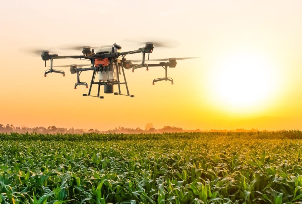
Precision Application of Inputs
In the quest for sustainable and efficient agricultural practices, the precise application of inputs like pesticides, fertilizers, and herbicides has become a critical goal. Drones, armed with advanced spraying systems, have emerged as a revolutionary solution that addresses this challenge head-on. By delivering these inputs with unparalleled precision, drones are transforming how we approach crop protection and nutrient management. This precision not only reduces wastage but also minimizes environmental contamination and the overuse of chemicals, ushering in a new era of responsible farming.
Traditional methods of input application involve ground-based machinery or manual labor, both of which are inherently limited in precision. Blanket application techniques can lead to overuse of chemicals in some areas and underuse in others, resulting in both economic losses and environmental concerns. Drones change this landscape by enabling precise and targeted application, optimized for the specific needs of each portion of the field.
Equipped with advanced spraying systems, drones offer several advantages in the realm of precision input application. The combination of GPS technology, sophisticated sensors, and controlled release mechanisms allows drones to accurately identify and target specific areas for treatment. Whether it’s a localized pest infestation or a need for nutrient supplementation, drones can navigate with precision to deliver the necessary inputs where they are needed most.
The benefits of this precision approach are multifaceted. First and foremost, it minimizes wastage. By avoiding unnecessary chemical application to healthy areas, farmers can optimize their resource utilization, ultimately reducing input costs. Secondly, the reduction in chemical usage has a positive impact on the environment. By targeting treatment to specific areas, drones help minimize the potential for chemical runoff and contamination of water sources.
Furthermore, precision input application with drones contributes to the reduction of chemical resistance in pests and weeds. Overuse of chemicals in blanket applications can lead to the development of resistance over time. By applying chemicals only where necessary, drones help preserve the efficacy of these inputs, ensuring their effectiveness in the long run.
Oryctes is the first high accuracy point-to-point agriculture spraying drone created specifically for oil palm as a proven solution against damaging pests such as Rhinoceros Beetles. Harnessing RTK positioning technology and a unique single-nozzle design, Oryctes sprays with centimetre-level precision. Precisely control the quantity and area of spraying to avoid using excessive pesticide.
Irrigation Management
Water, the lifeblood of agriculture, is a finite resource that must be managed with care. In a world where water scarcity and sustainable resource management are of paramount importance, drones are emerging as a valuable ally in the realm of irrigation. Equipped with sensors and data analysis capabilities, drones play a crucial role in optimizing irrigation schedules. By analyzing data collected through these sensors, drones help farmers prevent overwatering or underwatering in different areas of the field, leading to efficient water usage and enhanced crop growth.
Irrigation is a delicate balancing act. Providing too much water can lead to waterlogging, nutrient leaching, and diseases, while too little water can result in stunted growth and reduced yields. Traditional irrigation methods often rely on historical data, visual cues, or fixed schedules, which can lead to suboptimal water distribution and wastage.
Drones revolutionize this process by offering real-time insights into soil moisture levels, plant health, and overall field conditions. Equipped with sensors that measure soil moisture, temperature, and humidity, drones can accurately assess the moisture content of different areas of the field. This data is then analyzed and used to create irrigation maps that highlight areas with varying moisture levels.
With this information at hand, farmers can tailor their irrigation schedules to match the specific needs of each area. If a drone detects low soil moisture levels in a particular section of the field, farmers can increase irrigation in that area, ensuring that the plants receive the necessary water. Conversely, areas with optimal moisture levels can be irrigated less frequently, preventing overwatering.
The benefits of drone-guided irrigation management are significant. Firstly, it conserves water by avoiding excessive use, benefiting both the environment and water resources. Secondly, it promotes healthier plant growth by ensuring that crops receive the right amount of water at the right time. This translates to improved yields, as plants are not stressed by water-related issues.
Moreover, optimized irrigation management contributes to resource efficiency and cost savings. By using water more efficiently, farmers can reduce their water bills and optimize their overall input costs. This aligns with the broader goals of sustainable agriculture, where responsible resource management is crucial for long-term viability.
Yield Estimation
In the world of agriculture, anticipating the potential yield of a crop before harvest is more than just a number—it’s a strategic advantage. The ability to predict yields accurately enables farmers to plan their marketing strategies, make informed decisions about sales, and optimize their overall resource allocation. Drones, equipped with advanced sensors and data analysis capabilities, are transforming yield estimation by providing accurate and timely data that empowers farmers to make well-informed choices.
Traditionally, yield estimation involved labor-intensive methods such as manual sampling and counting, which were prone to inaccuracies due to the variations in field conditions. These methods could lead to underestimations or overestimations, resulting in marketing and sales strategies that did not align with the actual yield.
Drones change this landscape by offering a more comprehensive and efficient approach to yield estimation. As drones fly over fields, their sensors capture detailed data about plant health, growth patterns, and canopy density. This data is then processed and analyzed using sophisticated algorithms to create accurate yield predictions.
The benefits of drone-enabled yield estimation are multifaceted. Firstly, it provides farmers with insights into the potential performance of their crops, enabling them to plan their marketing strategies accordingly. If a drone predicts a bumper harvest, farmers can gear up for larger sales volumes and explore new distribution channels. Conversely, if a lower yield is projected, farmers can adjust their sales plans or explore options for value-added processing.
The accuracy of drone-generated yield predictions has a positive impact on supply chain management. Accurate yield estimations help prevent supply-demand mismatches, reducing the likelihood of surplus or shortage situations. This benefits both farmers and consumers by ensuring that products reach the market in the right quantities and at the right time.
Furthermore, drone-generated yield data can also aid in negotiating contracts and agreements with buyers, as farmers have reliable information about their expected harvests. This transparency builds trust in business relationships and contributes to smoother operations throughout the supply chain.
Early Pest Detection
In the intricate battle between agriculture and pests, early detection can be the key to victory. The timely identification of pest infestations allows farmers to take swift and targeted action, mitigating potential crop losses and ensuring healthy yields. Drones, armed with advanced sensors and data analysis capabilities, are emerging as a crucial tool in the realm of pest management. By scanning fields for signs of infestations, these aerial sentinels empower farmers with the ability to implement effective and precise pest control measures.
Pests—whether insects, diseases, or weeds—can wreak havoc on crops if left unchecked. Traditional methods of pest monitoring, often involving manual scouting or visual inspection, are time-consuming and may lead to delayed intervention. By the time visible symptoms appear, the damage might already be extensive.
Drones revolutionize this process by offering a proactive approach to pest detection. Equipped with multispectral and thermal sensors, drones can detect subtle changes in plant health, temperature variations, and pest activity that might not be immediately visible to the naked eye. This early identification provides farmers with a critical advantage in addressing pest issues before they escalate.
When a drone’s sensors detect unusual patterns or signs of infestations, farmers can take targeted action. For instance, if a specific area of a field shows signs of stress due to insect activity, farmers can deploy localized pest control measures. This targeted approach minimizes the need for blanket applications of pesticides, reducing chemical usage and potential environmental impacts.
The benefits of early pest detection by drones are manifold. Firstly, it helps prevent widespread crop losses by addressing pest issues before they become rampant. This translates to healthier plants and higher yields. Secondly, it minimizes the need for excessive pesticide application, which contributes to environmental sustainability by reducing chemical runoff and contamination.
Moreover, early pest detection is a proactive strategy that aligns with integrated pest management (IPM) principles. By intervening at the right time and using a combination of cultural, biological, and chemical control methods, farmers can achieve effective pest control while minimizing negative impacts on beneficial organisms and ecosystems.
Planting and Seeding
The act of planting and seeding has been elevated to a new level of precision and efficiency with the integration of drone technology. Drones designed for precision planting are revolutionizing the way farmers establish crops. By distributing seeds in optimal patterns for uniform growth, these aerial pioneers are minimizing seed waste, enhancing land utilization, and contributing to the future of sustainable and efficient agriculture.
Traditional planting methods often involve manual labor or machinery that might not achieve consistent seed placement. Uneven seed distribution can lead to irregular growth patterns, wasted seeds, and reduced crop yields. Drones equipped for precision planting change this dynamic by offering an agile and precise solution.
These specialized drones are equipped with seeding mechanisms that can precisely release seeds at predetermined intervals and depths. This level of control allows for the creation of even planting patterns, ensuring that each seed has the best chance of germination and growth. Moreover, the ability to adjust planting density based on specific crop requirements and soil conditions optimizes land utilization and crop performance.
The benefits of drone-enabled precision planting are substantial. First and foremost, it reduces seed waste. The precise placement of seeds eliminates overlaps and gaps, ensuring that seeds are distributed where they are needed without excess. This not only conserves seeds but also translates to direct cost savings for farmers.
Furthermore, precision planting has a direct impact on crop yields. Uniform plant growth resulting from consistent seed distribution leads to more even canopy development, better light utilization, and improved nutrient uptake. These factors collectively contribute to higher yields and better-quality crops.
Efficient land utilization is another key advantage of precision planting with drones. By optimizing the distribution of seeds, farmers can make the most out of their available land area. This is particularly valuable in regions with limited arable land, where maximizing crop productivity is essential for meeting food demands.
Livestock Monitoring
While drones have already proven their worth in revolutionizing crop management, their capabilities extend far beyond the realm of agriculture. Drones equipped with cameras and sensors are now playing a vital role in livestock monitoring, providing farmers with valuable insights into animal health, behavior, and overall well-being. By surveying herds from above, these flying sentinels contribute to the management and care of livestock in ways previously unimaginable.
The traditional methods of livestock monitoring, often involving manual checks and physical presence, can be time-consuming, labor-intensive, and sometimes inadequate in capturing a comprehensive view of animal health and behavior. Drones are changing this narrative by offering a bird’s-eye perspective that allows farmers to monitor their livestock more efficiently and accurately.
Equipped with high-resolution cameras and sensors, drones fly over pastures and barns, capturing detailed imagery and data about the animals below. This data can reveal important information such as signs of illness, injuries, or unusual behavior. By identifying these issues early, farmers can take prompt action to provide necessary care and prevent potential outbreaks.
Beyond health assessment, drones also help track herd movements and behavior patterns. This is particularly beneficial for extensive grazing systems where animals have access to large areas of land. Drones provide farmers with insights into grazing patterns, watering locations, and areas of congregation. This information can guide decisions about rotational grazing, resource allocation, and overall herd management strategies.
The benefits of drone-enabled livestock monitoring are significant. Firstly, it improves animal welfare by enabling early intervention and medical care. Prompt identification of health issues reduces suffering and prevents the spread of diseases within the herd. Secondly, it enhances operational efficiency by minimizing the need for manual checks and reducing labor costs associated with monitoring.
Moreover, drone technology also promotes sustainable farming practices. By optimizing grazing patterns and resource allocation, farmers can prevent overgrazing, soil erosion, and degradation of grazing lands. This aligns with the broader goals of responsible land stewardship and sustainable livestock production.
Soil Analysis
Beneath the surface of every field lies a world of complexity that holds the key to successful agriculture—soil. Understanding the intricacies of soil health, nutrient composition, and potential variations is crucial for informed decision-making in farming. Drones, equipped with cutting-edge technology and precise sampling mechanisms, are taking soil analysis to new heights. By collecting soil samples from diverse locations across a field, these airborne analysts offer comprehensive insights that empower farmers to optimize their nutrient management strategies and cultivation practices.
Conventional soil analysis methods often involve manual sample collection followed by laboratory testing. This process can be labor-intensive, time-consuming, and limited in its scope. Drones transform this approach by providing a more efficient and expansive method of soil sampling, particularly beneficial for larger fields or those with challenging topography.
Drones equipped for soil analysis are designed to gather samples from different points in a field with precision. These samples are then analyzed to determine essential soil properties, such as nutrient content, pH levels, organic matter, and moisture. The aggregated data forms a detailed map of soil characteristics, revealing potential variations and allowing farmers to fine-tune their management practices.
The advantages of drone-facilitated soil analysis are manifold. Firstly, it furnishes farmers with an intricate understanding of soil health and nutrient distribution, enabling them to adjust their nutrient management strategies based on the specific requirements of different areas within the field. This precision not only prevents over- or under-fertilization but also ensures optimal crop growth.
Secondly, the data gleaned from drone-acquired soil samples aligns with sustainable agricultural practices. By accurately assessing nutrient levels and soil health, farmers can optimize their fertilizer applications, reducing the risk of nutrient runoff and contamination of water bodies.
Furthermore, the insights from drone-driven soil analysis facilitate informed decisions about soil amendments and improvement practices. By identifying areas with low organic matter content, compaction issues, or other concerns, farmers can implement targeted solutions to enhance soil structure, fertility, and overall health.
Post-Harvest Assessment
The culmination of the growing season is marked by harvest—a pivotal moment that reflects the culmination of a farmer’s efforts and decisions. However, the journey doesn’t end there. Drones equipped with advanced imaging technology extend their reach beyond the harvest, offering farmers valuable insights for post-harvest assessment. By capturing data after the harvest, drones empower farmers to evaluate the outcomes of different cultivation practices, facilitating continuous improvement in subsequent seasons.
The traditional approach to post-harvest assessment often involves manual inspections and observations, which might provide a limited view of overall crop performance. Drones change this paradigm by offering a comprehensive and data-rich perspective. Equipped with high-resolution cameras and sensors, drones can survey the entire field, capturing detailed imagery and data about crop conditions, residue levels, and more.
This post-harvest data serves as a valuable resource for farmers as they analyze the results of their cultivation practices. By comparing the actual outcomes with their initial goals and expectations, farmers can identify patterns, trends, and areas for improvement. This knowledge guides decisions about adjustments in planting techniques, irrigation strategies, pest management approaches, and more.
The benefits of drone-powered post-harvest assessment are multifaceted. Firstly, it provides farmers with data-driven insights into the effectiveness of their practices. For example, if a drone’s imagery reveals uneven crop distribution or residues left behind after harvest, farmers can assess factors that might have contributed to these outcomes, such as planting densities or machinery settings.
Secondly, post-harvest drone data fosters a culture of continuous improvement. Armed with concrete information about what worked well and what needs refinement, farmers can refine their strategies for subsequent seasons. This iterative approach contributes to increased efficiency, higher yields, and better resource utilization over time.
Moreover, the historical data collected through post-harvest drone assessments serves as a knowledge base for long-term decision making. Farmers can track changes in crop performance over multiple seasons, enabling them to identify trends and make informed choices that optimize their overall operation.
Conclusion
Drones have undoubtedly altered the landscape of agriculture, redefining how farmers interact with their fields and crops. The applications discussed above showcase the versatility and potential of drone technology in addressing various challenges faced by modern agriculture. As drones continue to evolve and become more sophisticated, their contributions to precision farming, resource management, and sustainable practices will only grow. By embracing drones, farmers are not only enhancing their own productivity and profitability but also contributing to a more resilient and efficient global food supply chain.