Introduction
Disaster management is a critical field that requires swift and effective responses to mitigate the devastating impact of natural and man-made catastrophes. In recent years, drones have emerged as powerful tools in disaster management efforts, revolutionizing the way we prepare for, respond to, and recover from disasters. From search and rescue operations to damage assessment and relief distribution, drones have proven invaluable in improving efficiency, safety, and effectiveness in disaster management. In this article, we will explore how drones are transforming the landscape of disaster management.
What is Disaster Management?
Disasters can take various forms. Human-caused disasters, such as industrial explosions or structural breakdowns, are the result of human error. Natural catastrophes are caused by physical occurrences such as earthquakes and droughts. Complex disasters might include epidemics or armed conflicts.
Disasters, in whatever shape they take, disturb communities and can have major consequences for people, property, businesses, and the environment. They frequently test a community’s ability to cope.
Disaster management is the process of planning for and responding to natural disasters. It entails carefully organizing resources to mitigate the damage caused by calamities. It also entails a systematic strategy to handling catastrophe prevention, readiness, response, and recovery duties.
How Drones Assist in Disaster Management
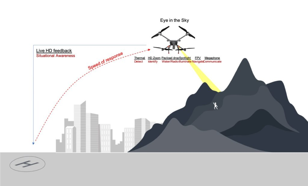
Enhancing Search and Rescue Operations
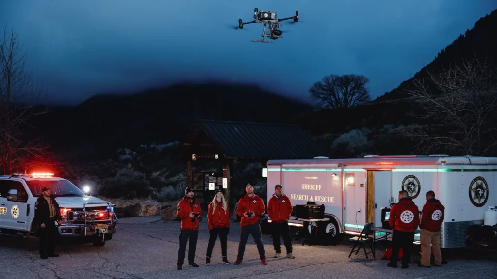
During a disaster, every second counts in saving lives and ensuring the safety of affected individuals. Drone equipped with high-resolution cameras, thermal imaging sensors, and advanced aerial capabilities have become indispensable in search and rescue operations. They can quickly cover vast areas that are difficult for human rescuers to access and provide real-time situational awareness to aid decision-making.
Drones can rapidly identify survivors in remote or inaccessible locations, allowing rescue teams to allocate their resources more effectively. They also help locate missing persons by employing thermal imaging technology, which detects body heat signatures event in low-light or obscured conditions. Furthermore, drones equipped with speakers or communication device can establish communication channels with survivors, offering reassurance and guidance until help arrives.
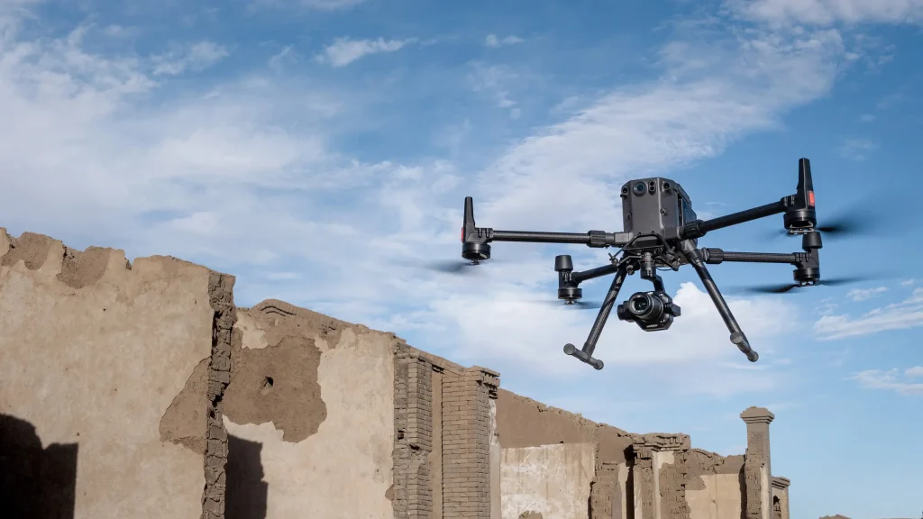
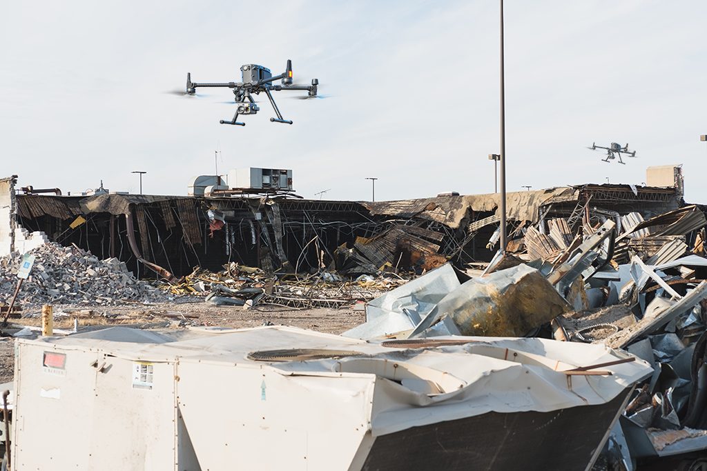
Efficient Damage Assessment
In the aftermath of a disaster, accurately assessing the extent of damage is crucial for effective resource allocation and planning. Drones equipped with high-definition cameras and LiDAR (Light Detection and Ranging) technology can provide comprehensive and detailed imagery of affected areas, including infrastructure damage, blocked roads, and hazardous conditions. This data helps authorities prioritize response efforts, target critical areas, and deploy resources where they are most needed.
By rapidly surveying large areas, drones significantly reduce the time and resources required for manual inspections. They can quickly identify potential dangers, such as unstable structure, and assess the structural integrity of buildings and infrastructure. This information allow experts to make informed decisions about evacuations, clearance operations, and restoration efforts, minimizing the risk faced by emergency responders and speeding up the recovery process.
Logistics and Relief Distribution
Drones play a vital role in the logistics and distribution of essential supplies during and after disasters. They can transport critical medical supplies, food, water, and other relief materials to affected areas, even in situations where ground transportation is challenging or impossible. This capability is particularly significant in isolated or hard-to-reach locations.
Equipped with GPS technology and capable of vertical takeoff and landing, drones can swiftly reach affected areas, by passing roadblocks, damaged infrastructure, and flooded regions. They ensure a timely and efficient delivery of aid, providing relief to survivors and alleviating the burden on ground-based relief operations. Drones also assist in creating aerial maps to help relief agencies identify suitable locations for setting up temporary shelters, aid distribution centers, and medical facilities.
Data Collection and Analysis
Drones serve as data collection platforms, capturing valuable information to support informed decision-making and long-term disaster management strategies. They can collect aerial imagery, video footage, and sensor data, which are then analyzed to identify patterns, trends, and potential risks. This data-driven approach enables authorities to make evidence-based decisions, allocate resources effectively, and implement preventive measures to mitigate the impact of future disasters.
Using advanced imaging techniques, drones can monitor environmental factors, such as flood levels, wildfire spread, or hazardous gas emissions. They can also aid in assessing changes in terrain, identifying potential landslides, or detecting damage to critical infrastructure, such as bridges, or power lines. This real-time information helps authorities understand the evolving situation on the ground and adapt their response accordingly.
Popular Drones Used During Disaster Management
DJI Matrice 300 RTK
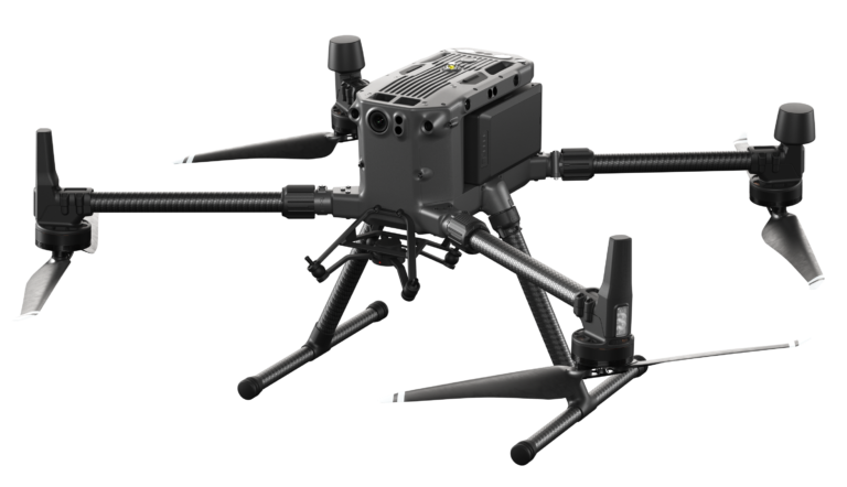
DJI’s industry standard commercial drone platform that takes inspiration from modern aviation systems. Offering up to 55 minutes of flight time, advanced AI capabilities, 6 Directional Sensing & Positioning and more, the M300 RTK sets a whole new standard by combining intelligence with high-performance and unrivaled reliability.
DJI Matrice 30T
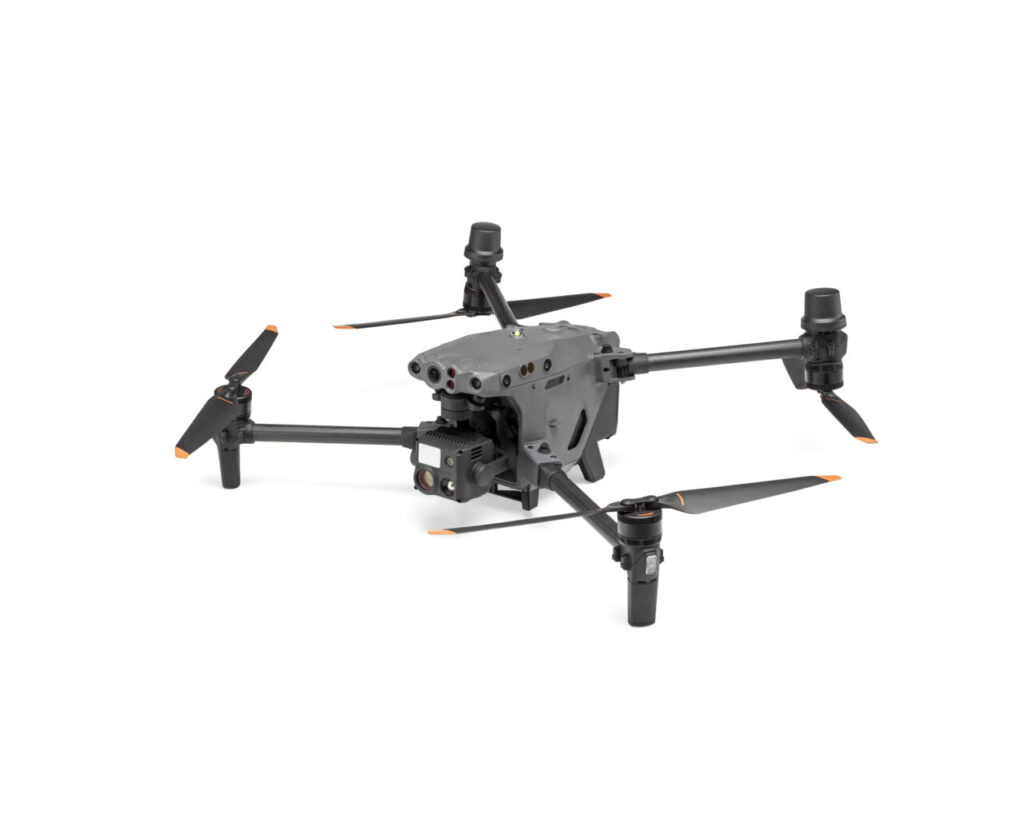
The Matrice 30 series integrates multiple high-performance sensors into a lightweight and portable body. Equipped with a remote controller designed for enterprise users and the newly upgraded Pilot 2 flight app, to improve the efficiency of drone operations. Compatible with the FlightHub 2 cloud platform and DJI Dock to achieve cloud collaboration and remote deployment operations.
DJI Mavic 3 Enterprise
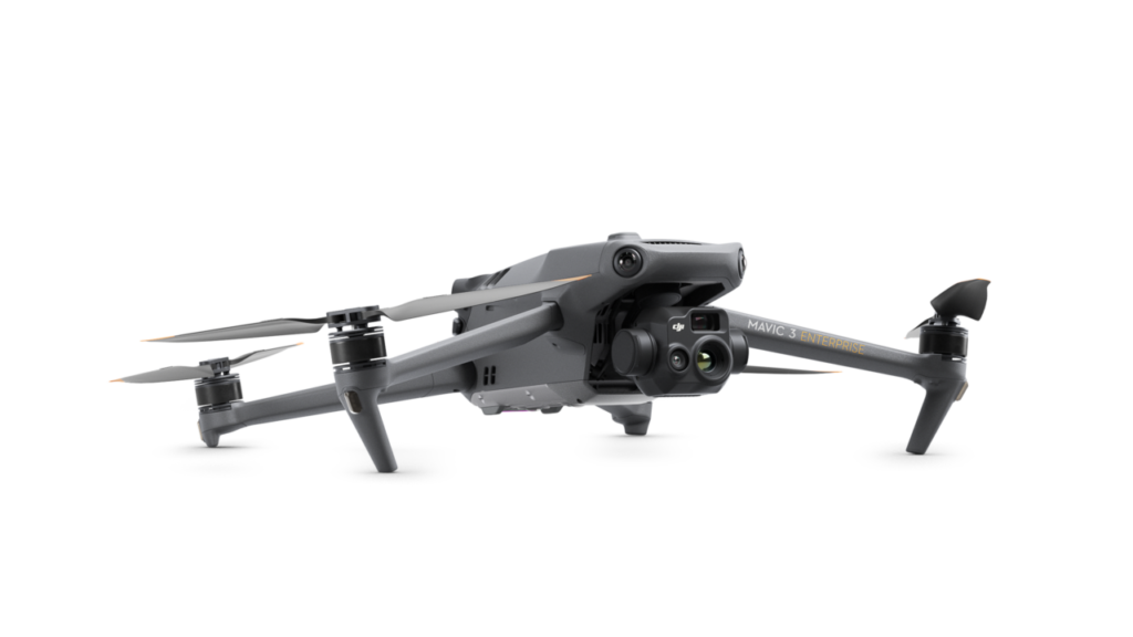
The DJI Mavic 3 Enterprise redefines industry standards for small commercial drones.
With a mechanical shutter, a 56× zoom camera, and an RTK module for centimeter-level precision, the Mavic 3E brings mission efficiency to new heights. A thermal version is available for firefighting, search and rescue, inspection, and night operations.
Conclusion
Drones have become indispensable assets in disaster management, revolutionizing the way we approach preparedness, response, and recovery efforts. Their ability to rapidly survey vast areas, enhance search and rescue operations, assess damage, and deliver critical supplies has proven invaluable in saving lives, reducing risks for emergency responders, and expediting the recovery process. As drone technology continues to advance, we can expect even greater integration of these unmanned aerial systems in disaster management strategies, ensuring more effective and efficient responses to future calamities.
References
Drone for Disaster Management- How Drones are Used for Emergency Response
What Is Disaster Management? Understanding Emergencies From Prevention to Mitigation