Introduction
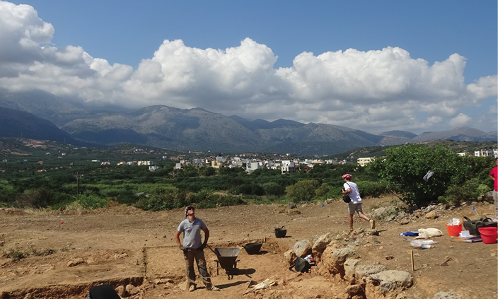
In the world of land surveying and 3D mapping, professionals face a critical decision when choosing between LiDAR scanning and traditional surveying techniques. Both methodologies offer distinct advantages and limitations, making it imperative to grasp the key differences. In this comprehensive comparison, we’ll explore the strengths and weaknesses of LiDAR scanning and traditional surveying, as summarized in the table below.
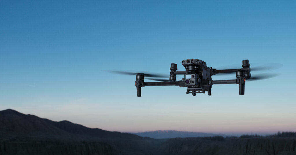
What is LiDAR Scanning?
LiDAR, short for Light Detection and Ranging, is a cutting-edge technology that utilizes laser beams to measure distances with remarkable precision. It operates on a simple principle: it sends out laser pulses and measures the time it takes for them to bounce back after hitting an object or surface. These measurements are then used to create detailed 3D maps and models. Now, let’s delve into the comparative analysis.
LiDAR Scanning vs Traditional Surveying
| Aspect | LiDAR Scanning | Traditional |
|---|---|---|
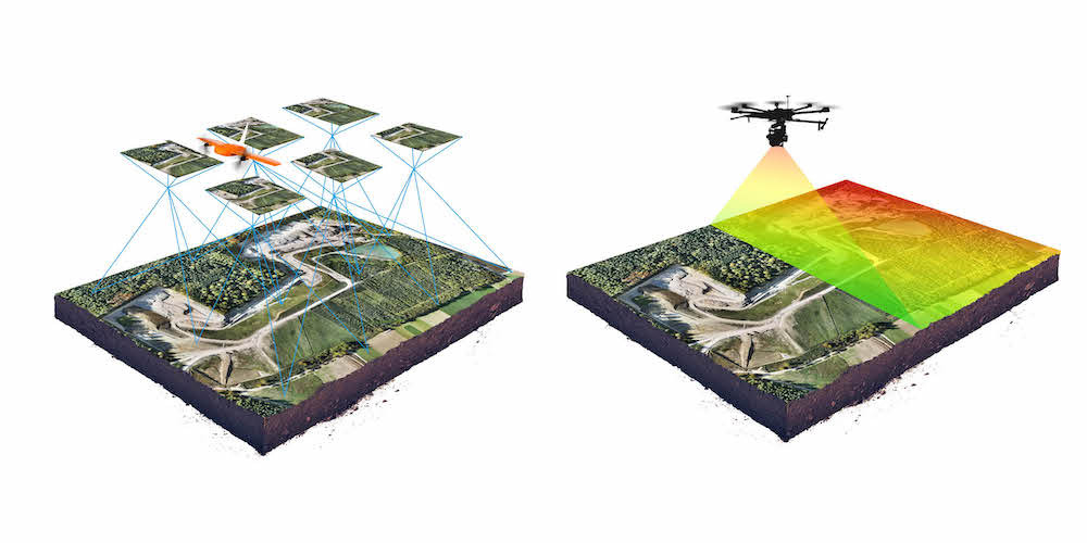
| Speed and Efficiency | LiDAR scanning employs laser beams to collect data rapidly, capturing thousands of data points per second. This speed is particularly beneficial for large-scale projects requiring timely data acquisition. | Traditional surveying methods often involve manual measurements, which can be slower. As a result, it is better suited for smaller projects with less stringent time constraints. |
| Accuracy in 3D Mapping | LiDAR scanners are renowned for their precision, even in challenging terrains. They excel at creating highly accurate elevation models, making them ideal for topographic mapping and tasks demanding precise spatial data. | Traditional surveying’s accuracy can vary and may be influenced by human error. While it is capable of providing accurate measurements, it may not match the consistency and precision of LiDAR scanning. |
| Human Error in 3D mapping | LiDAR scanning minimizes the risk of human error by automating the data collection process. This ensures that measurements are highly accurate and consistent. | Traditional surveying methods, often involving manual measurements, are susceptible to human error. Variability in measurement accuracy can arise due to the human element involved in data collection. |
| Safety and Accessibility | LiDAR scanners are capable of accessing remote or hazardous areas safely, such as dense forests or construction sites. This makes them invaluable for various applications, including forestry management and infrastructure inspection. | Traditional surveying methods are limited to accessible areas and may not be suitable for challenging terrains or hazardous environments. They are preferable for projects in straightforward, accessible locations. |
| Cost-Effectiveness | LiDAR scanning typically involves higher initial costs, but it can be cost-effective for large-scale projects that demand precision, speed, and safety. | Traditional surveying equipment is generally more affordable, but costs may be incurred in labor for manual data collection. It can be cost-effective for smaller projects with budget constraints. |
| Simplicity and Portability | LiDAR scanning systems may require complex setup and calibration. They are typically less portable due to their advanced technology and equipment. | Traditional surveying equipment is simpler to set up and more portable, making it suitable for quick assessments and smaller-scale projects. |
| Weather Dependence | LiDAR scanning can be impacted by adverse weather conditions like heavy rain or fog, potentially affecting data quality. | Traditional surveying methods are less susceptible to weather disruptions, making them suitable for various weather conditions. |
Speed and Efficiency
LiDAR Scanning:
LiDAR scanning is renowned for its incredible speed and efficiency in data collection laser beams to collect data points rapidly, capturing thousands of measurements per second. This rapid data acquisition is particularly advantageous for large-scale projects where timely data collection is crucial. It enables professionals to quickly gather vast amounts of highly accurate spatial data, making it a go-to choice for projects demanding efficiency and precision.
Traditional Surveying:
Traditional surveying methods, in contrast, often rely on manual measurements using tools like theodolites, total stations, and tape measures. These manual processes can be time-consuming and may not match the speed and efficiency of LiDAR scanning. Traditional surveying is better suited for smaller-scale projects with less stringent time constraints.
Accuracy in 3D Mapping
LiDAR Scanning:
LiDAR scanners are celebrated for their exceptional accuracy, even in challenging terrains and environments. They excel at creating highly accurate elevation models, making them indispensable for topographic mapping, flood risk assessment, and monitoring changes in landscapes over time. The precision of LiDAR scanning ensures that surveyors can confidently rely on the data for critical decision-making in a variety of applications.
Traditional Surveying:
While traditional surveying methods can provide accurate measurements, their accuracy can vary and may be influenced by human error. Variability in measurement accuracy can arise due to the manual nature of data collection. This makes traditional surveying suitable for projects where a high level of precision is not paramount.
Human Error Risk
LiDAR Scanning:
LiDAR scanning minimizes the risk of human error by automating the data collection process. Surveyors do not need to manually record measurements, reducing the chances of inaccuracies caused by human factors. This automated approach ensures that data remains consistent and reliable, enhancing the overall quality of the survey results.
Traditional Surveying:
Traditional surveying methods often involve manual measurements and human interpretation of instruments. These manual processes introduce the potential for human error, which can affect the accuracy of data collected. Professionals using traditional surveying techniques must be vigilant to minimize inaccuracies in their measurements.
Safety and Accessibility
LiDAR Scanning:
LiDAR scanners are highly versatile in terms of safety and accessibility. They can access remote or hazardous areas safely, such as dense forests or construction sites, without putting surveyors at risk. This capability is particularly valuable in applications like forestry management, disaster assessment, and infrastructure inspection, where access to challenging terrain or hazardous environments is required.
Traditional Surveying:
Traditional surveying methods are generally limited to accessible areas and may not be suitable for challenging terrains or hazardous environments. Surveyors using traditional techniques must consider the safety of their fieldwork and may need to exclude certain locations from their surveys due to accessibility concerns.
Cost-Effectiveness
LiDAR Scanning:
LiDAR scanning typically involves higher initial costs, primarily due to the purchase and maintenance of advanced equipment. However, it can be cost-effective for large-scale projects that demand precision, speed, and safety. The efficiency of LiDAR scanning often results in significant time savings, which can offset the initial investment.
Traditional Surveying:
Traditional surveying equipment is generally more affordable in terms of upfront costs. However, costs may be incurred in labor for manual data collection, particularly for larger projects requiring more extensive fieldwork. Traditional surveying methods can be cost-effective for smaller projects with budget constraints.
Simplicity and Portability
LiDAR Scanning:
LiDAR scanning systems may require complex setup and calibration due to their advanced technology. They often involve the installation and alignment of laser scanners and GPS equipment. While they are capable of delivering highly accurate data, their complexity can pose challenges in terms of setup and portability.
Traditional Surveying:
Traditional surveying equipment is simpler to set up and more portable in comparison to LiDAR scanning systems. Surveyors using traditional methods often rely on well-established tools like total stations and theodolites, which are relatively straightforward to operate and transport. This simplicity and portability can be advantageous for quick assessments and smaller-scale projects.
Weather Dependence
LiDAR Scanning:
LiDAR scanning can be impacted by adverse weather conditions such as heavy rain, fog, or snow, which can obstruct or scatter laser beams. These weather-related factors can potentially affect data quality and accuracy, making it necessary to consider weather conditions during data collection planning.
Traditional Surveying:
Traditional surveying methods are generally less susceptible to weather disruptions, making them suitable for various weather conditions. Surveyors can continue their work even in inclement weather, which can be advantageous for projects that require consistency regardless of weather conditions.
Conclusion
The choice between LiDAR scanning and traditional surveying should be guided by careful consideration of project-specific needs and objectives. Key factors to evaluate include project size, terrain complexity, budget constraints, and the desired level of accuracy.
LiDAR scanning excels in scenarios where precision, speed, and safety are paramount, such as large-scale infrastructure projects, disaster assessments, or complex topographic mapping. Its automated data collection, exceptional accuracy, and accessibility to challenging terrains make it an ideal choice for such applications.
Conversely, traditional surveying methods may be preferable for smaller projects with budget constraints and in situations where surveyors are well-versed in these methods. They can provide accurate measurements for straightforward projects and can be a cost-effective choice in the right context.
In conclusion, the choice between LiDAR scanning and traditional surveying hinges on a careful evaluation of project needs, objectives, and constraints. Technology continues to advance in both fields, and staying informed about the latest developments is essential for professionals to make informed decisions and deliver superior results to their clients.