Introduction
In recent years, technology has brought about significant advancements in various fields, and one of the most remarkable developments is aerial mapping. Aerial mapping involves the use of drones equipped with advanced imaging technologies to capture high-resolution imagery and data from above. This cutting-edge technique has revolutionized the way we visualize and understand the world around us. In this article, we will explore the concept of aerial mapping, its numerous benefits, its wide-ranging applications, and specifically delve into the types of DJI drones commonly used for this purpose.
What is Aerial Mapping?
Aerial mapping, also known as drone mapping or aerial surveying, is a techniques that utilizes unmanned aerial vehicles (UAVs) – commonly known as drones – to capture geospatial data, imagery, and other information from an elevated perspective. These drones are equipped with sophisticated sensors such as cameras, LiDAR (Light Detection and Ranging) devices, and GPS systems, enabling them to collect precise and comprehensive data about the earth’s surface and its features.
The process involves deploying the drones to fly over a designated area in a systematic pattern, capturing images and data at specific intervals. Once the data is collected, it is processed using specialized software to create highly detailed maps, 3D models, and topographical representations of the area.
8 Benefits of Aerial Mapping
Aerial mapping offers a plethora of benefits that have made it increasingly popular across a wide range of industries. Let’s explore some of the key advantages in greater detail:
Environmental Conservation
Aerial mapping has become a vital tool for environmentalists and conservationists. By providing accurate data on forests, wildlife habitats, and ecosystem health, it aids in identifying areas that require protection or restoration efforts. The ability to monitor changes in natural environments over time helps detect issues such as deforestation, soil erosion, and habitat loss.
Infrastructure Planning and Maintenance
When it comes to planning new infrastructure or maintaining existing structures, aerial mapping shines. It enables engineers and construction planners to obtain detailed information about the terrain, waterways, and potential obstacles. Such data helps them design projects with minimal environmental impact and ensures safer and more efficient construction.
Emergency Response and Disaster Management
Aerial mapping plays a crucial role in emergency situations, such as natural disasters and accidents. Rapidly deployed drones can assess damage, identify hazards, and locate survivors in hard-to-reach areas. This real-time data assists emergency responders in coordinating rescue efforts and allocating resources effectively.
Mining and Resource Exploration
The mining industry benefits from aerial mapping by gaining valuable insights into potential mining sites and resource exploration. Drones equipped with mineral sensors can identify deposits and assess their size and quality, streamlining mining operations and minimizing environmental disturbances.
Tourism and Cultural Heritage Preservation
In the tourism sector, aerial mapping contributes to promoting travel destination by showcasing scenic landscapes, historical sites, and cultural landmarks from stunning perspectives. For cultural heritage preservation, aerial mapping aids archaeologists, and historians in documenting and ancient structures and artifacts without causing damage.
Flood Mapping and Management
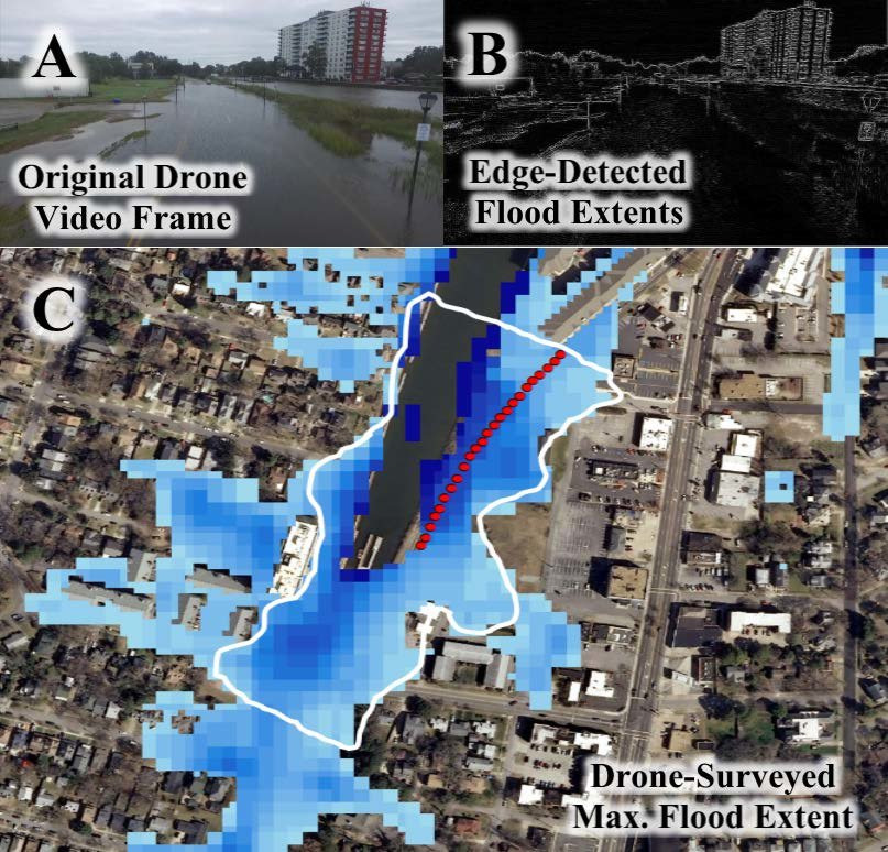
Aerial mapping helps predict and manage floods by providing up-to-date information on water levels and flood-affected areas. Governments and disaster management agencies can use this data to implement preventive measures and conduct rescue operations during floods.
Wildlife Monitoring and Conservation
Drones equipped with thermal imaging and high-resolution cameras aid in monitoring wildlife populations and their behavior. This information assists conservationists in understanding animal habitats, tracking migration patterns, and identifying potential threats to endangered species.
Surveying in Challenging Terrain
Aerial mapping is particularly beneficial in inaccessible or challenging terrains such as mountain, forests, and remote regions. Traditional survey methods may be impractical or dangerous in such areas, but drones can efficiently capture data and images without risking human lives.
Applications in aerial mapping
The applications of aerial mapping are diverse, and its potential spans across various industries. Let’s explore some of the key applications in greater detail:
Urban Planning and Development
Aerial mapping plays a crucial role in urban planning, as it provides valuable insight into the layout of cities, infrastructure, and land usage. This information aids city planners in making informed decisions regarding development and zoning regulations. It helps optimize land use, manage traffic flow, and plan for future growth.
Agriculture and Precision Farming
Drones equipped with multispectral cameras can assess crop health, identify irrigation issues, and monitor plant growth. Precision agriculture techniques based on aerial mapping data lead to optimized crop yields and reduced resource wastage. Farmers can target specific areas that need attention, saving both time and resources.
Environmental Monitoring
Aerial mapping helps in monitoring and managing natural resources, such as forests, water bodies, and wildlife habitats. It aids in identifying changes in ecosystems, deforestation, and detecting illegal activities like poaching. By tracking environmental changes over time, researchers and conservationists can develop strategies for protecting biodiversity.
Infrastructure Inspection
Aerial mapping is used for inspecting and maintaining infrastructure like bridges, railways, and power lines. It enables engineers to detect structural issues and plan maintenance effectively. Regular inspections with drones can prevent potential disasters and extend the lifespan critical infrastructure.
Disaster Management
During natural disasters or emergencies, aerial mapping provides real-time data for search and rescue operations, damage assessment, and relief efforts. Drones can quickly survey affected areas, identify hazards, and help prioritize rescue efforts, ultimately saving lives.
Archaeology and Cultural Heritage Preservation
Aerial mapping has become an essential tool for archaeologists to survey and map historical sites and cultural heritage. It allows for a non-invasive assessment of ancient ruins, monuments, and artifacts, aiding in their preservation and documentation.
4 Types of DJI Drones for Aerial Mapping
DJI (Dà-Jiāng Innovations Science and Technology Co., Ltd.), a renowned drone manufacturer, offers a range of drones suitable for aerial mapping applications. Some popular DJI drone models used in aerial mapping include:
DJI Phantom 4 RTK
This drone is equipped with Real-Time Kinematic (RTK) technology, which provides centimeter-level accuracy in positioning. It is ideal for surveying and mapping applications that require high precision. The RTK capability allows for more accurate 3D mapping and volumetric measurements.
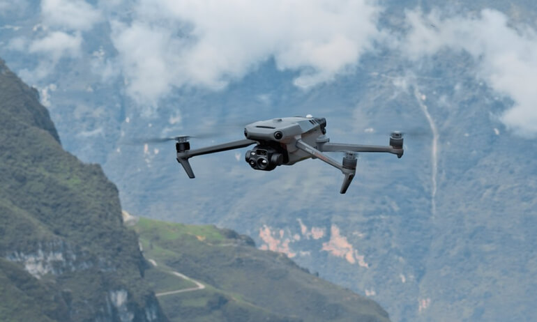
DJI Mavic 3 Enterprise
This revolutionary drone for mapping application with its small and portable size. Combine with its larger sensors and mechanical shutter, it is ideal for surveying and mapping applications that require high precision.
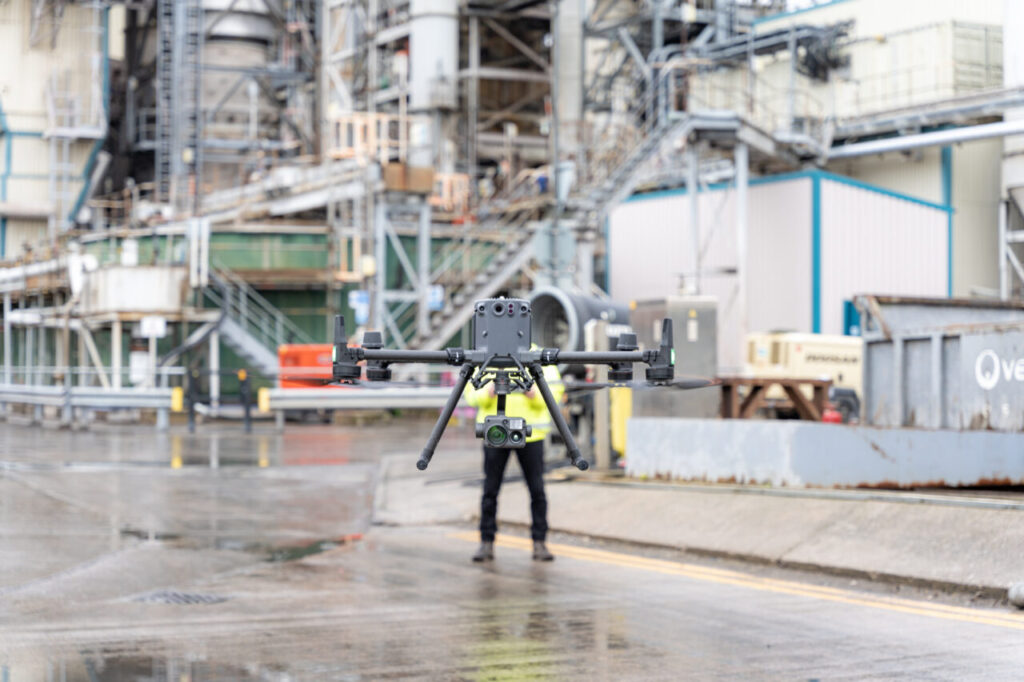
DJI Matrice 300 RTK
Designed for industrial applications, this drone boasts advanced flight performance and obstacle sensing capabilities. It can carry multiple payloads, including high-resolution cameras and LiDAR sensors. The Matrice 300 RTK is favored for its reliability in challenging environments and long flight endurance.
DJI Matrice 350 RTK
An upgraded flagship drone platform, the Matrice 350 RTK sets a new benchmark for the industry. This next-generation drone platform features an all-new video transmission system and control experience, a more efficient battery system, and more comprehensive safety features, as well as robust payload and expansion capabilities. It is fully powered to inject innovative strength into any aerial operation.
Conclusion
Aerial mapping has emerged as a game-changer in many fields, providing invaluable data, insights, and visuals from a unique vantage point. Its precision, efficiency, and versatility have made it an indispensable tool for urban planning, agriculture, environmental monitoring, infrastructure inspection, disaster management, and beyond. As technology continues to evolve, aerial mapping is likely to expand its horizons, enabling us to better comprehend and manage our world from above. With DJI continuously pushing the boundaries of innovation, the future of aerial mapping appears promising, holding the potential to transform industries and enrich our understanding of the planet.