Introduction
In recent years, the advent of mapping drones has brought about a significant transformation in the field of geospatial data collection. These unmanned aerial vehicles (UAVs) equipped with advanced imaging technologies have revolutionized the way we map and understand our environment. This article delves into the capabilities of mapping drones, their applications across various industries , and the impact they are making on the field of geospatial data collection.
What is a Mapping Drone
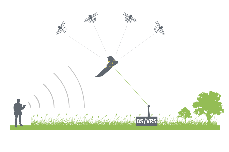
A mapping drone, also known as a surveying or aerial mapping drone, is an unmanned aerial vehicle (UAV) specifically designed for capturing aerial imagery and data to create maps, models, and geospatial datasets. These drones are equipped with various sensors, such as high-resolution cameras, LiDAR sensors, and GPS receivers, to gather accurate and detailed information from above.
Mapping drones are programmed to follow predefined flight paths or operate in a controlled manner, capturing images and data at specific intervals or locations. The collected data is then processed using specialized software to generate orthomosaics (georeferenced aerial images), digital elevation models (DEMs), 3D point clouds, and spatial datasets.
The main purpose of mapping drones is to efficiently and effectively collect geospatial data over larger areas that may be challenging to access or time-consuming to survey using traditional ground-based methods. The resulting maps and models can be used in a wide range of applications, including urban planning, construction and infrastructure development, agriculture, environmental monitoring, disaster response, and more.
Mapping drones have revolutionized the field of geospatial data collection by offering faster, more cost-effective, and highly accurate solutions compared to traditional surveying techniques, They provide a bird’s-eye view of the landscape, allowing for comprehensive coverage and detailed analysis of the surveyed area.
Mapping Drone Technology and Capabilities
Mapping drones are equipped with high-resolution cameras. LiDAR (Light Detection and Ranging) sensors, and GPS systems, allowing them to capture precise and detailed imagery of landscapes, structures, and objects from the sky. These devices can collect data from different angles, heights, and perspectives, enabling the creation of accurate three-dimensional models and maps. With their advanced imaging capabilities, mapping drones can capture data that was once difficult or time-consuming to obtain using traditional surveying methods.
Applications Across Industries
Construction and Infrastructure
Mapping drones are widely employed in construction and infrastructure development projects. They provide real-time site monitoring, enabling project managers to track progress, identify potential issues, and make informed decisions. Drones can also create accurate topographic maps, aiding in land surveying and designing infrastructure projects.
Agriculture
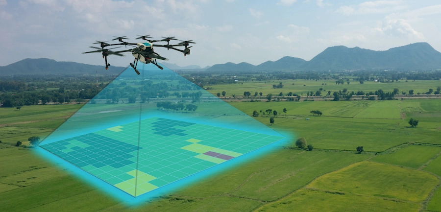
In the agricultural sector, mapping drones assist in crop management, precision farming, and yield optimization. By capturing high-resolution aerial imagery, these drones can identify variations in crop health, detect diseases, monitor irrigation systems, and analyze vegetation indices. This data helps farmers make data-driven decisions, reduce costs, and increase crop productivity.
Environmental Monitoring
Mapping drones have become invaluable tools for environmental scientists and conservationists. They enable the monitoring of forests, wildlife habitats, and sensitive ecosystems, providing insights into biodiversity, deforestation, and land degradation. Drone can also assist in disaster response, mapping affected areas after natural calamities like earthquakes or floods.
Urban Planning and Real Estate
Mapping drones aid in urban planning and real estate development by capturing detailed aerial images of cities and landscapes. This data helps planners analyze land use patterns, infrastructure requirements, and potential development areas. Real estate professionals use mapping drones to create compelling visuals for property listings and assess the feasibility of construction projects.
Benefits of Mapping Drones
- Efficiency: mapping drones significantly improve efficiency in geospatial data collection. They can cover large areas in a fraction of the time it would take using traditional surveying methods. This time-saving aspect allows for quicker decision-making and reduces overall project timelines.
- Cost-effectiveness: Mapping drones offer a cost-effective solution for gathering geospatial data. They eliminate the need for extensive ground-based surveying equipment and manual labor. The reduced resources required result in cost savings, making mapping drones an attractive option for various industries and organizations.
- Accuracy and Precision: Mapping drones capture high-resolution imagery and data, resulting in accurate and precise geospatial information. The advanced imaging sensors and GPS receivers on mapping drones enable precise positioning and measurement, leading to reliable maps, 3D models, and other geospatial datasets.
- Safety: Mapping drones provide a safe alternative to traditional surveying methods, particularly in hazardous or hard-to-reach environments. Instead of putting surveyors at risk, drones can be deployed to collect data from aerial perspectives, avoiding potential dangers and ensuring the safety of personnel.
- Flexibility and Versatility: Mapping drones offer flexibility in terms of flight paths and data collection parameters. They can be programmed to follow specific flight paths, capture data at desired intervals, and adapt to varying terrain conditions. This versality allows for tailored data collection based on project requirements.
- Real-time Monitoring: Mapping drones equipped with live-streaming capabilities enable real-time monitoring of projects and areas of interest. This feature is particularly valuable for construction sites, disaster response, and environmental monitoring, allowing immediate assessment and informed decision-making.
- Enhanced Data Analysis: The data collected by mapping drones can be processed using advanced software tools to generate detailed maps, 3D models, and analytical insights. This enables better visualization, analysis, and interpretation of geospatial data, leading to more informed decision-making in various industries.
- Environmental Benefits: Mapping drones have a lower environmental impact compared to traditional surveying methods. They require fewer resources and have a reduced carbon footprint, contributing to sustainable practices in geospatial data collection.
Conclusion
Mapping drones have emerged as a game-changer in geospatial data collection, offering improved efficiency, accuracy, and versatility. Their applications span across industries, from construction and agriculture to environmental monitoring and urban planning. As the technology evolves and challenges are overcome, mapping drones are set to play an increasingly vital role in our efforts to understand and manage the world around us.
Watch the video below from DJI Enterprise for more information on what is drone mapping: